
MacRitchie Reservoir is my favorite place to get a good workout. It is definitely one of the best places for runners and hikers to clock their mileage in Singapore.
I got to know about MacRitchie Reservoir years ago, when I was into running in my twenties. I would spend at least once a week to run the entire loop of MacRitchie Reservoir, which is about 11km long. It is a place that always gives me inexplicable happiness (which was, perhaps, caused by the adrenaline rush that I got from running).
If you’re a runner looking for a new place to train, I highly recommend running at MacRitchie. Its rugged terrain will train your strength, agility, flexibility and resistance the way that road running never does.
If you’re a leisure jogger or walker, looking to improve your fitness over the weekend, MacRitchie has easy and short trails that you can attempt in an hour or less.
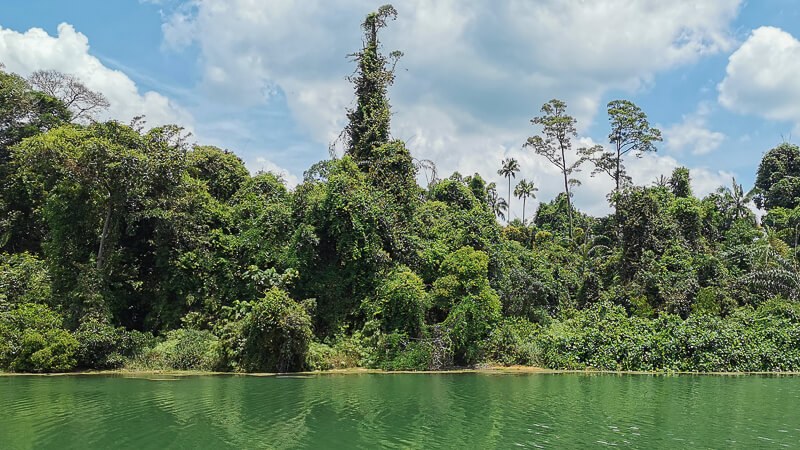
Not into running or jogging? You don’t have to. You can just sit by the reservoir and just being present in the moment, you can kayak, you can photograph the wildlife, you can have a meal in the park, etc. Basically, it is a place for anyone who loves nature.

Have any questions about traveling in Singapore? Join All About Singapore Travel FB group, I'll be there to answer your questions!
In this post, I will provide detailed information and tips that you need to know before visiting MacRitchie Reservoir.
TABLE OF CONTENT
1. Opening Hours
2. How to get to MacRitchie Reservoir
3. What to Bring
4. What to Wear
5. Facilities
6. Trails of MacRitchie Reservoir
7. Suggested Routes
8. Things to do in MacRitchie Reservoir
9. What not to do in MacRitchie Reservoir
10. Nearby Parks
11. Nearby Food
12. FAQ
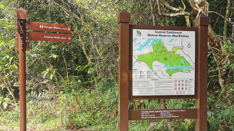
1. OPENING HOURS

MacRitchie Reservoir Park’s opening hours are from 7am to 7pm daily. Entering or remaining in the park after 7pm is not allowed.
TreeTop Walk’s opening hours are from 9am to 5pm (Tuesdays to Fridays) and 8.30am to 5pm on weekends & public holidays. The trail is closed on Mondays unless it’s a public holiday. Last entry is at 4:45pm.
Mushroom Cafe’s opening hours are from 8am to 5pm, Tuesdays to Sundays & Public Holidays.
Paddle Lodge’s opening hours are from 9am to 6pm daily. It’s closed on selected Public Holidays (like Christmas, New Year and Chinese New Year).
2. HOW TO GET TO MACRITCHIE RESERVOIR
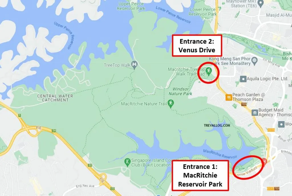
There are 2 main entrances to MacRichie Reservoir: one at MacRitchie Reservoir Park, and the other one at Venus Drive.
Which entrance is better? If your goal is to get to TreeTop Walk ASAP, then choose Venus Drive. If your goals are to relax by the reservoir, do kayaking, or simply enjoy easy trails, choose MacRitchie Reservoir Park. If your goals is to complete the entire loop, I recommend starting at MacRitchie Reservoir Park.
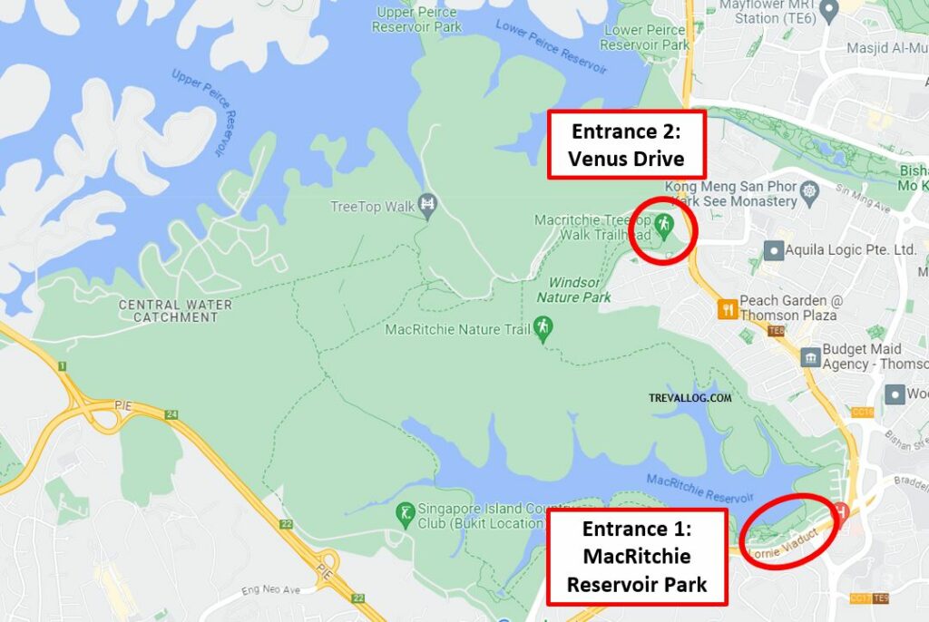
Ways to get to MacRitchie Reservoir Park:
- By MRT: Take MRT to Caldecott Station, take exit A, walk westward along Toa Payoh Rise, turn right to Thomson Road, then walk northward along Thomson Road. It is a 900-m walk.
- By bus: Take bus 52 from Bishan Interchange; Bus 74, 130, 132, 165, 166, 167 from Ang Mo Kio; Bus 93, 165, 855 from Farrer Road MRT; 157 from Toa Payoh Interchange, bus 162, 852 from Yio Chu Kang MRT.
- By car: There’s a carpark at MacRitchie Reservoir Park which you can enter via Lornie Road.
Ways to get to Venus Drive:
- By MRT: The nearest MRT is Upper Thomson MRT. Take Exit 5, then take bus 132, 163, 165,166, 167, 855, 980 and alight 2 stops later at Opp Flame Tree Park bus stop, then walk for 3 mins to Venus Drive Entrance. Alternatively, from Upper Thomson MRT, you can take Exit 1 and walk to Venus Drive Entrance, it’s about 1km long (13-min walk).
- By bus: Take bus 52 from Bishan Interchange; Bus 132, 165, 166, 167 from Ang Mo Kio; bus 410 from Marymount MRT; bus 162 from Yio Chu Kang MRT.
- By car: There’s a carpark at Venus Drive but it’s really small and is often full on weekends and Public Holidays. Alternative carparks are Thomson Plaza or nearby HDB flats.
3. WHAT TO BRING
These are the things I recommend you bring if you are planning to spend some time on the trails of MacRitchie Reservoir.
Water. This is the number one item you need to prepare before your visit. There are very limited water points and vending machines at MacRitchie, so I recommend bringing your own water bottle or hydration bag. Outside the trail, you can buy drinks at Mushroom Cafe and from vending machine near Paddle Lodge. Inside the trail, there is only 1 water point, which is at Ranger Station. If you’re concerned about hygiene, I recommend bringing your own drink rather than drinking from water fountain.
Mosquito repellent. Unless you’re wearing long pants and long sleeve shirt or you’re moving really fast, there’s possibility that you get mosquito bites, so do apply mosquito repellent or mosquito patch.
Sunblock, caps or umbrella. Even though most of the trails are covered by dense foliage, there are certain stretches that have no shades at all (like the Golf Link, Rifle Range Road and MacRitchie Reservoir Park). So, do protect your skin with sunblock or umbrella. Also, umbrella will protect you from unforeseen rain.
Cash and coins. You’ll need coins to buy drinks from vending machine or use the lockers; they don’t accept cards yet.
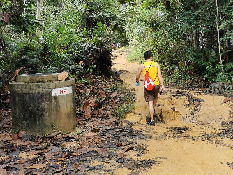
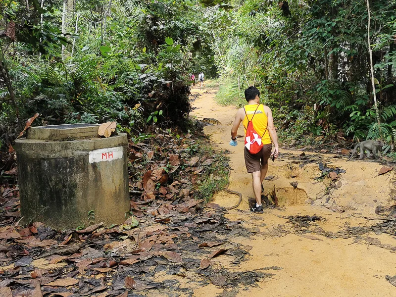
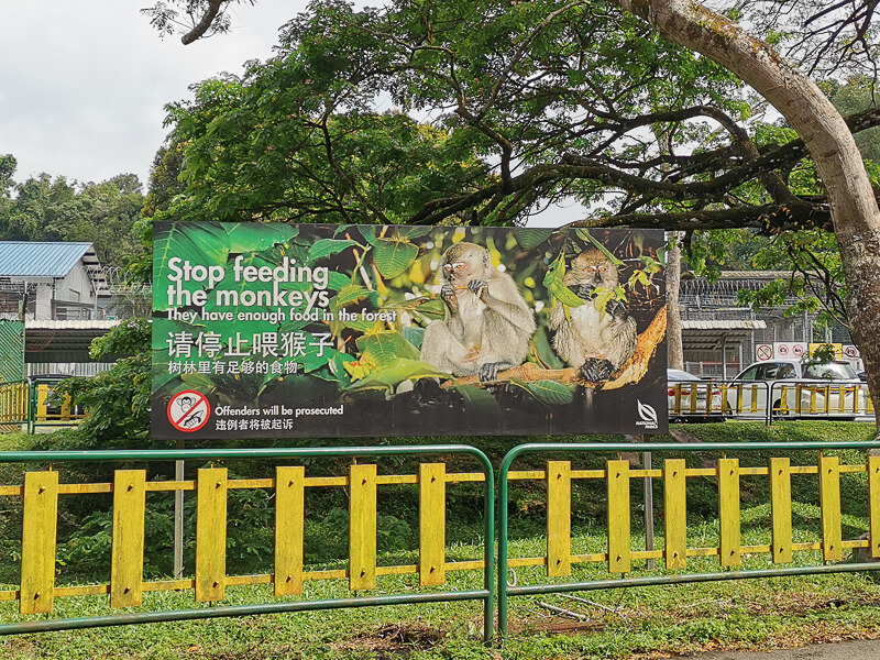
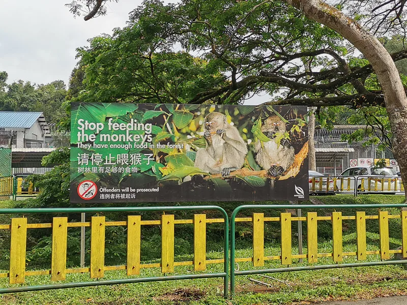
Light bites. If you’re attempting a long distance trek, you may need to refuel at some point, so do bring some light bites. BUT… DO NOT BRING FOOD IN A PLASTIC BAG, or you’ll have a hard time with the monkey. Keep your food in your backpack instead. And remember not to leave your trash in the nature.
Walking pole (optional). Even though there are lots of slopes, I personally don’t feel the need to bring a walking pole. Unless you have a knee problem, I think walking pole is unnecessary and cumbersome.
4. WHAT TO WEAR
Footwear: If you’re going to tackle the rugged trails, wear a proper trail shoes; I don’t recommend sandals or flip flops because nature can be rough. But, if you’re just going to hang around MacRitchie Reservoir Park or only going to walk the boardwalks, then any footwear is fine.
Tops & Bottoms: Similarly, if you’re going for the trails, wear proper sportwear. Otherwise, if you’re not going into the trails, any clothing is fine.
Headwear: A cap if you’re a cap person.
5. FACILITIES
In this section, I’ll compile all of the facilities and their location in MacRitchie Reservoir, for your easy reference.
Carpark:
– MacRitchie Reservoir Carpark (Location)
– Venus Drive Carpark (Location)
– Windsor Park Carpark (Location)
Toilet:
– Near mushroom cafe (Location)
– Behind empty building, near zigzag bridge (Location)
– Ranger Station (Location)
– Windsor Nature Park, near Venus Drive (Location)
Drinks:
– Mushroom cafe (Location)
– Vending machine at Paddle Lodge (Location)
– Water fountain at Ranger Station (Location)
– Water fountain at Windsor Nature Park (Location)
Food:
– Mushroom cafe (Location)
Locker:
– Locker at Paddle Lodge (Location)
6. THE TRAILS OF MACRITCHIE RESERVOIR
There are so many trails in MacRitchie Reservoir, the option can be paralyzing for beginners. I will try to simplify the explanation for each trails to give you an overview of what you can expect from the trails.
Before you visit MacRitchie, do get familiar with MacRitchie’s map, plan your itinerary in advance, and check NPark’s website to see if there’s any maintenance works that will affect your itinerary.
For the sake of simplicity, I will categorize the trails of MacRitchie into 3 categories: Super Easy trails, Short trails, and Long / Difficult trails.
Super Easy Trails
Below is the list of Super Easy trails, which are suitable for families with kids.
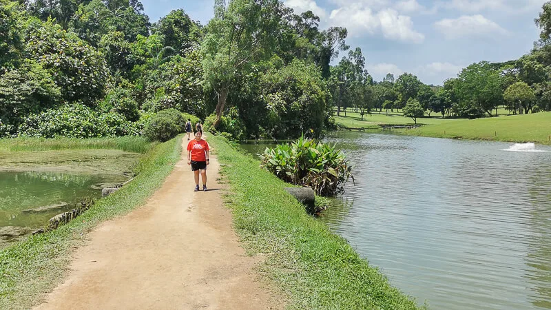
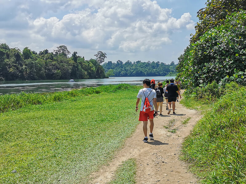
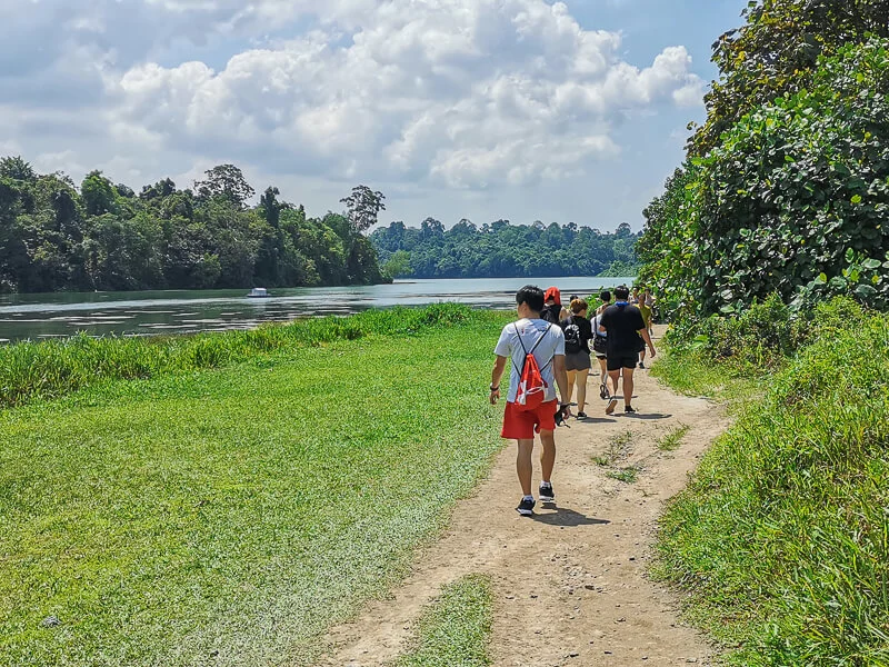
Super Easy Trail #1: Prunus Boardwalk & Petai Boardwalk. Located a couple of hundred meters away from Paddle Lodge, near MacRitchie Reservoir Park entrance, Prunus & Petai boardwalk are 2km long in total and are perfect trails to admire the reservoir and at the same time watch kayakers in action.
Super Easy Trail #2: Chemperai Boardwalk & Jering Boardwalk. Located at the west of MacRitchie Reservoir Park entrance, these 2 trails are also about 2km long in total. The views you’ll get here are tranquil view of the reservoir.
Super Easy Trail #3: Hanguana Trail (Part of Windsor Nature Park, near Venus Drive entrance). At 350m long, this is a very short trail and easy trail.
Super Easy Trail #4: Squirrel Trail (Part of Windsor Nature Park, near Venus Drive entrance). Also at 350m long, Squirrel Trail is located further inside of Windsor Nature Park.
Super Easy Trail #5: Drongo Trail connects Windsor Nature Park and MacRitchie Nature Trail. It is one of my favorite trails in MacRitchie because it is an elevated boardwalk. It is about 600m long.

Short Trails
The 3 Short trails below are suitable for people who want to do short hikes:
Short Trail #1: Lornie Trail. This 2km trail connects MacRitchie Reservoir Park to Golf Link. Despite its short distance, Lornie Trail has some demanding slopes. It’s a great trail for people who want to exercise but are not confident enough to tackle the entire loop of MacRitchie Reservoir. Lornie trail is just next to Chemperai & Jering Boardwalk.
Short Trail #2: Venus Loop. This 1.5km trail near Venus Drive entrance is great for people wanting to do a trail run but don’t have enough time to do longer trails.
Short Trail #3: Venus Link. This 1km trail is just next to Drongo Trail. It is narrow and has difficult slopes.
Long/Difficult Trails
These Long / Difficult trails are suitable for long-distance runners and trekkers:
Long/Difficult Trail #1: MacRithchie Nature Trail (3 km) connects Venus Link and MacRitchie Reservoir Park. It is a mostly downhill trail from Venus Link towards the Park, but if you do it the other way, it’s an uphill trail.
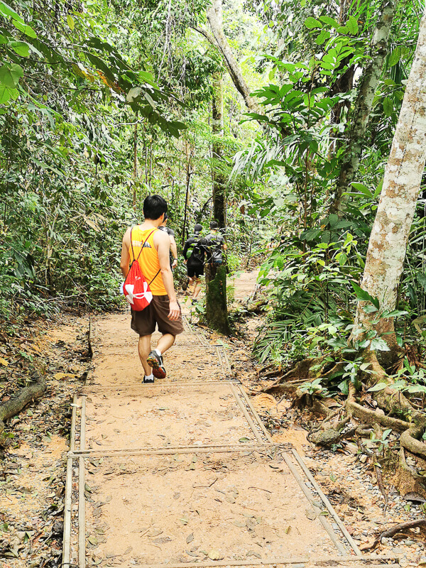
Long/Difficult Trail #2: TreeTop Walk trail (2km) starts near Ranger Station and ends at Petaling Hut. Don’t be fooled by the distance, the hike from Ranger Station to TreeTop Walk is TOUGH. But, it’s worth the effort because the view at TreeTop Walk is out of this world.
Long/Difficult Trail #3: Sime Track is the alternative to TreeTop Walk. It connects Golf Link and Ranger Station.
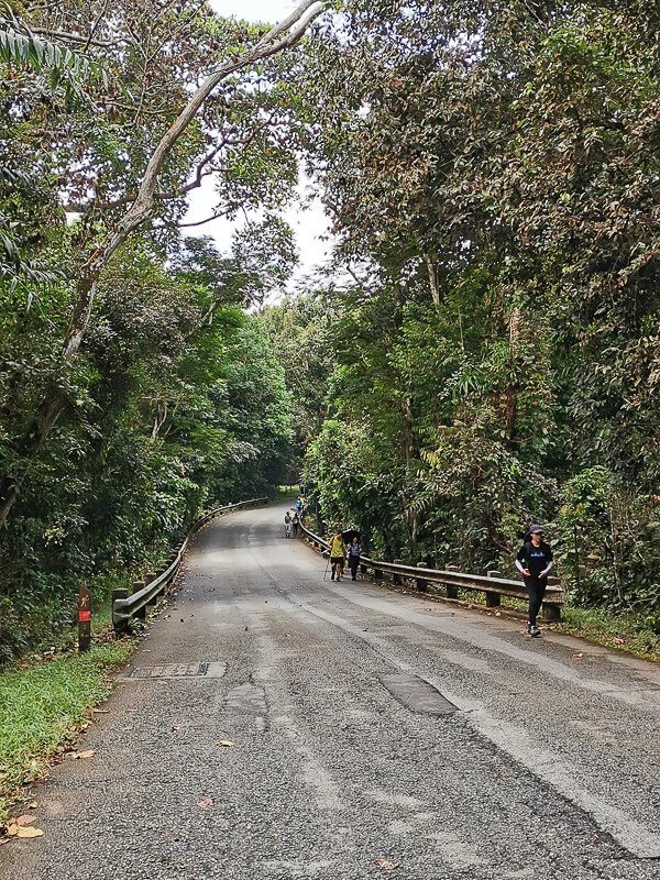
Long/Difficult Trail #4: Rifle Range Link & Rifle Range Road are the trails that connect MacRitchie Reservoir and Bukit Timah Nature Reserve. Riffle Range Link is a narrow trail. Meanwhile, Riffle Range Road is a road with live traffic and no running trails, so be cautious when you run here.
Long/Difficult Trail #5: Golf Link (2.3km) is an unforgiving trail in terms of heat. 50% of the trails are pretty sheltered by the foliage, but the other 50% has no shade! If you’re doing the entire loop, you can’t escape this stretch, so brace yourself.

7. MY SUGGESTED ROUTES
To be honest, there are so many possible combination of routes in MacRitchie. I can write all of the combinations but I feel that it won’t be useful because we tend to get into analysis paralysis when given too many choices. So, instead of giving you headache, I’ll just share my top 3 favorite routes at MacRitchie Reservoir.

Full Loop (12km)
To do the entire full loop of MacRitchie Reservoir, you can start from either MacRitchie Reservoir Park or Venus Drive. And you can choose whether to do it clockwise or anti-clockwise.
My personal favorite full loop is to start at MacRitchie Reservoir Park and run clockwise. I choose clockwise because I prefer to tackle the nightmare stretch of Golf Link early (I hate that stretch of unsheltered trails).
Another reason is this: if I get too tired and want to give up, or if I am too slow to make it out of the trail before dark, I can end my run at Venus Drive, which is about 8km from my starting point.
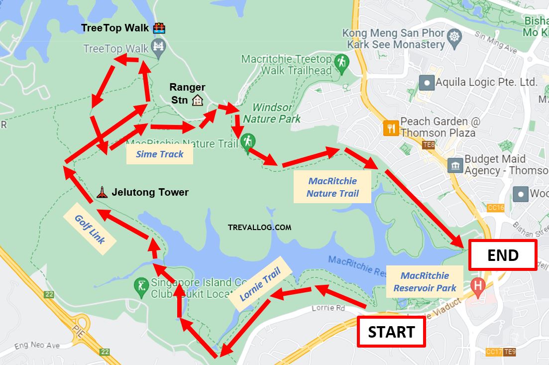
Here’s the chronicles (or itinerary) of my favorite full loop at MacRitchie Reservoir:
- Start at MacRitchie Reservoir Park.
- Run/walk through Lornie Trail and Golf Link.
- Stop by Jelutong Tower if I want to see the forest from above.
- Run/walk through Sime Track.
- Run/walk up to TreeTop Walk, then come down via Petaling Trail.
- Stop at Ranger Station to go to toilet and freshen up.
- Run/walk through MacRitchie Nature Trail.
- Back at MacRitchie Reservoir Park.

Venus Drive – TreeTop Walk – Venus Drive (7km)
This is the route that I’ll choose if my priority of the day is to visit the beautiful TreeTop Walk. TreeTop Walk is about 3 km from Venus Drive, hence the round trip is approximately 7 km.
By the way, before you visit TreeTop, do check their opening hours and whether they’re closed for maintenance, by scrolling up to the section where I write about Opening Hours.
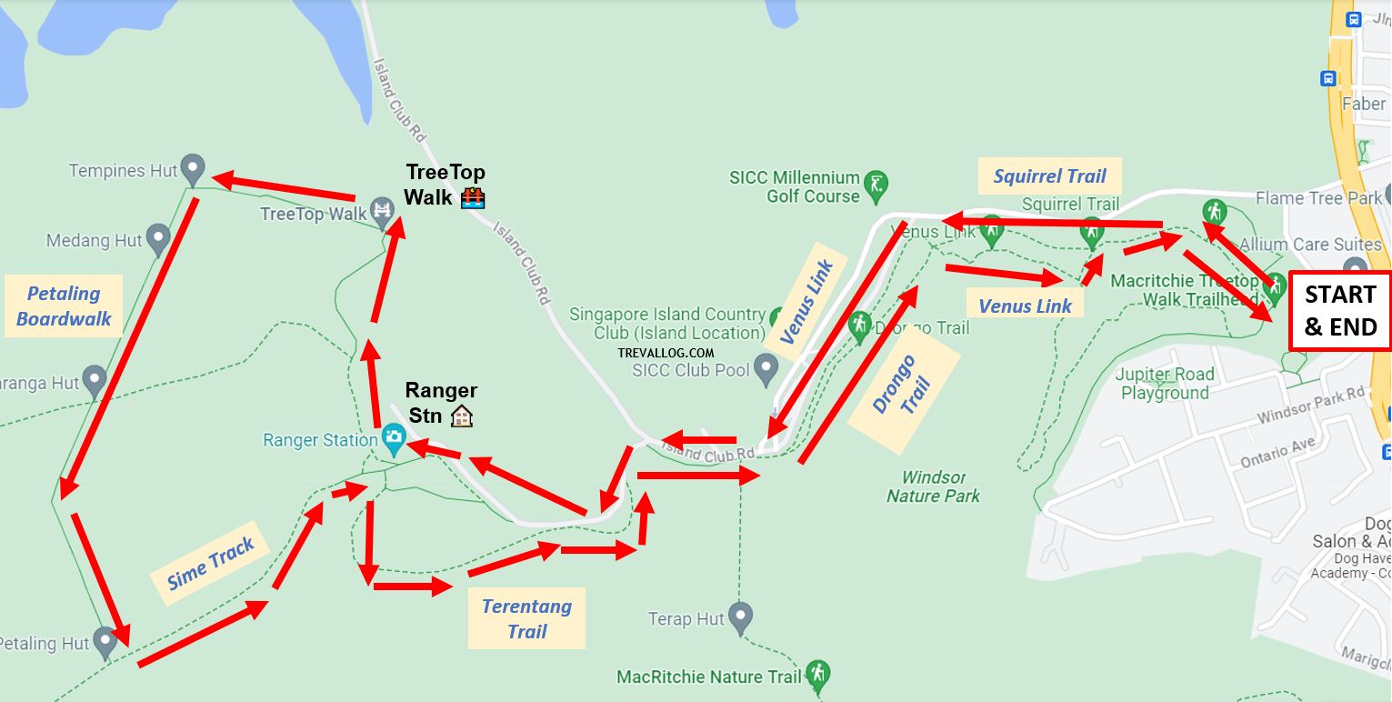
The Venus Drive to TreeTop Walk route is pretty simple.
- Start at Venus Drive entrance.
- Run/walk through Venus Link towards Ranger Station.
- A couple of meters after Ranger Station, you’ll see a sign pointing to TreeTop Walk. Follow this sign and walk up the steep hill.
- Enjoy your walk at TreeTop Walk.
- Exit the walk at the other end of the bridge (it is a one-way path).
- Run/walk through Petaling Trail.
- Run/walk through Sime Track and Venus Link.
- Back at Venus Drive.

Venus Drive – Bukit Timah Nature Reserve (9km)
This is the route that I’ll choose if I want to tackle both MacRitchie Reservoir and Bukit Timah Nature Reserve in a day. You can also choose to start from MacRitchie Reservoir Park, but you’ll be tackling a slightly longer distance if you choose that way.
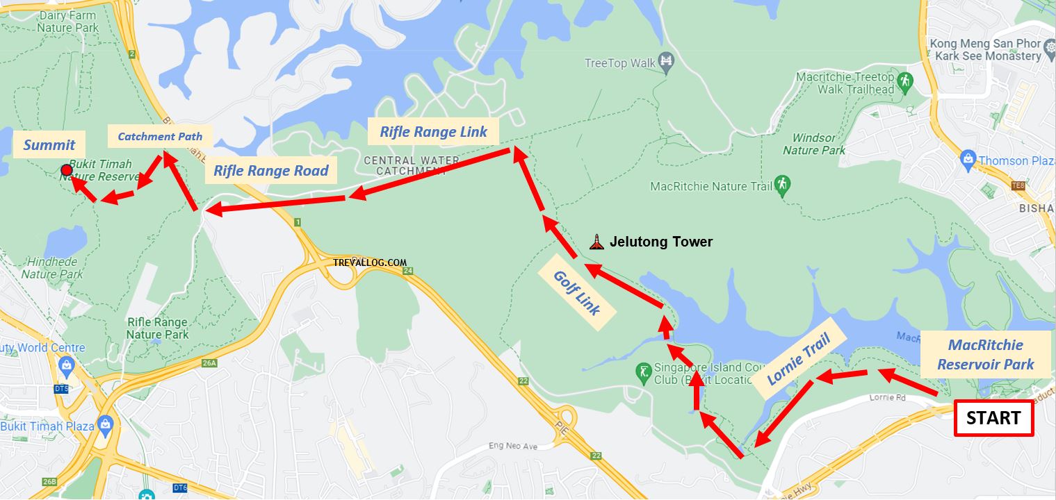
Here’s my step by step route from Venus Drive to Bukit Timah:
- Start at Venus Drive entrance.
- Run/walk through Venus Link and Sime Track, passing through Ranger Station.
- Before reaching Jelutong Tower, you’ll see a fork. One way leads to Bukit Timah Nature Reserve and the other way leads to MacRitchie Reservoir Park. Follow the sign to Bukit Timah Nature Reserve.
- Run/walk through Rifle Range Link.
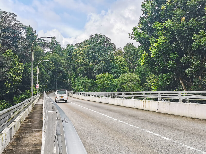
- Run/walk through Rifle Range Road. Be very careful here because there’s no proper jogging track, you’re basically jogging on the road with live traffic, so keep to your left.
- After crossing the busy BKE, turn right and run/walk along Catchment Path
- Run/walk towards Bukit Timah Hill Summit.


Easy Strolls
If you just want easy strolls, both MacRitchie Reservoir Park entrance & Venus Drive entrance have so many easy trails, but personally I prefer MacRitchie Reservoir Park because there are more amenities there and more things to see. At Venus Drive, there’s only 1 toilet and a couple of trails (no cafe, benches or scenic sights).

8. THINGS TO DO IN MACRITCHIE RESERVOIR
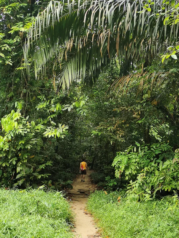
1. Trail Running
In my personal opinion (and I’m extremely biased), MacRitchie Reservoir is probably the best place for trail running in Singapore. It offers many distance options (you can do short ones like 5K, or you can do long ones up to 12K).
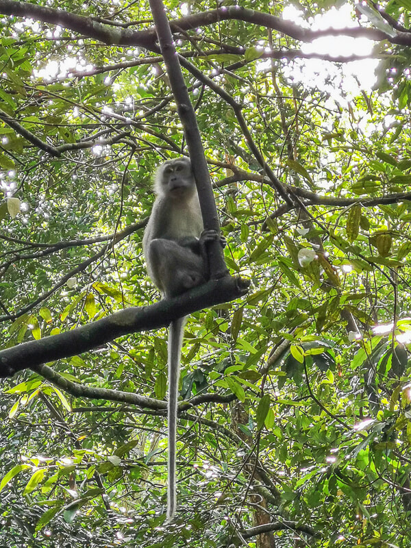
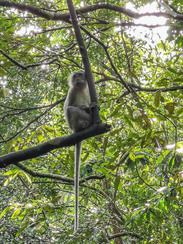
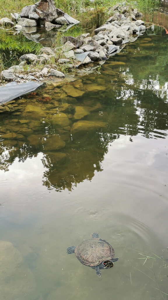
Most part of the trail are shaded (you can run at noon and still not get sun-burned), animal encounter is aplenty (monkey, monitor lizard, squirrel, and even snake), there are elevation gain & loss involved. So, you’ll get a really good workout by doing trail running at MacRitchie.
If you’re an avid runner, check out my favorite places to run in Singapore.

2. Walking or Trekking or Hiking
MacRitchie Reservoir attracts not only runners, but also trekkers or hikers. The entire loop of MacRitchie Reservoir can be completed in 3 to 4 hours, depending on each person’s stamina and speed.
Furthermore, the Lornie Trail in MacRitchie Reservoir is a part of Coast to Coast Trail that spans 36km from Jurong Lake Gardens to Coney Island. If you’re more into hiking than running, I really recommend hiking at MacRitchie Reservoir.
3. Walk the TreeTop Walk
Visiting MacRitchie without going to TreeTop Walk is like visiting Singapore without going to see Merlion. Well, unless the TreeTop Walk is closed for maintenance.
TreeTop Walk is a 250-meter long freestanding suspension bridge that connects the two highest points in MacRitchie: Bukit Peirce and Bukit Kalang. The total length of the walkway is about 250 m and its height from the forest floor varies, with the highest point at 25 m.
It is not for the faint hearted, because the bridge can get shaky when it gets crowded. It is a one-way bridge, so you have to walk from the beginning to the end, and you can’t u-turn back to the starting point. Admission is free.


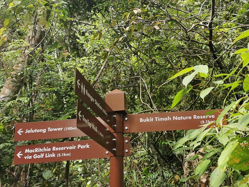
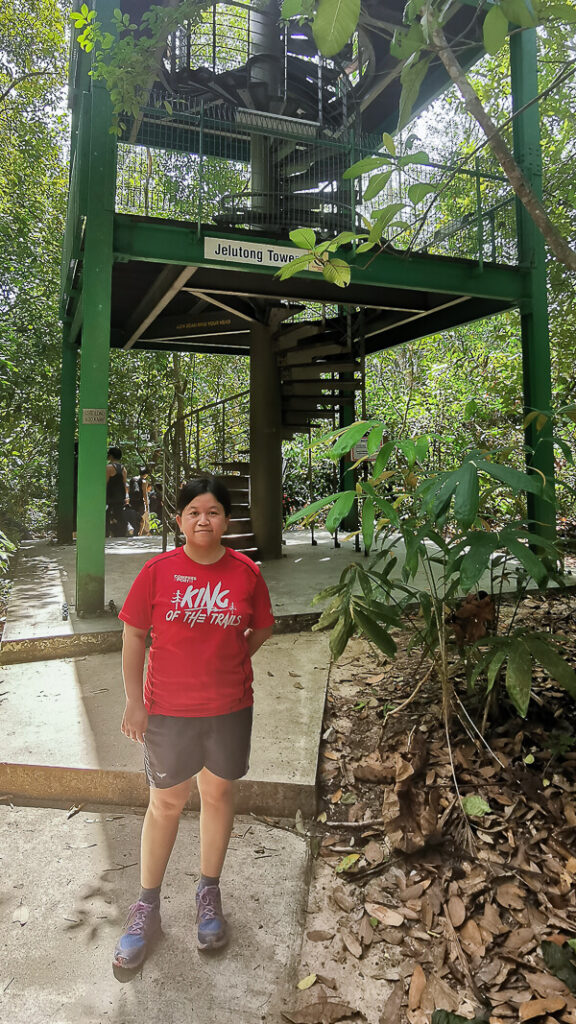
4. Climb Jelutong Tower
Jelutong Tower is a 7-deck observation tower that offers visitors an unobstructed overview of the forest in MacRitchie. The fastest way to get to Jelutong Tower is to start at Venus Drive, then walk through Venus Link, Ranger Station and Sime Track.
Jelutong Tower is made of steel frame with timber planks, so it gets shaky especially when you’re at the top. The spiral staircase is pretty narrow, do be careful when climbing up and down.
Jelutong tower is a favorite place for hikers to fuel up because there are many benches at every storey. The clever monkeys know this too! So I recommend not to snack here unless you want to risk your food getting snatched by them.
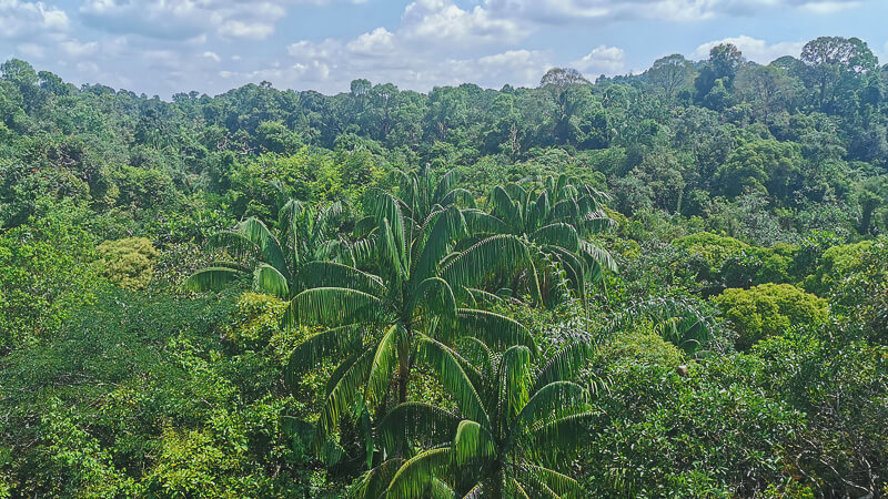
The view at the top of the tower is mostly green forest, with a hint of water body. It’s not possible to see the entire MacRitchie because the tower is just now tall enough. The rooftop is not sheltered, so it gets really hot when there’s no wind.


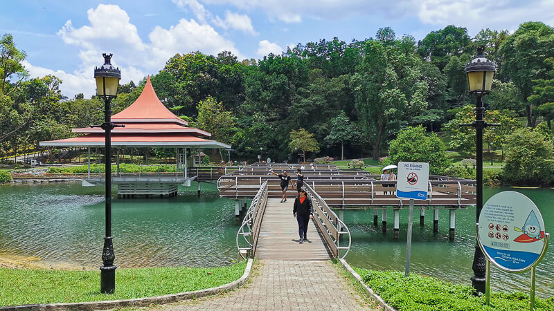
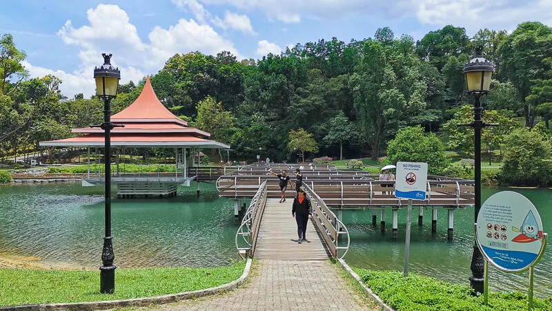
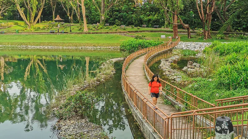
5. Walk through Zigzag Bridge
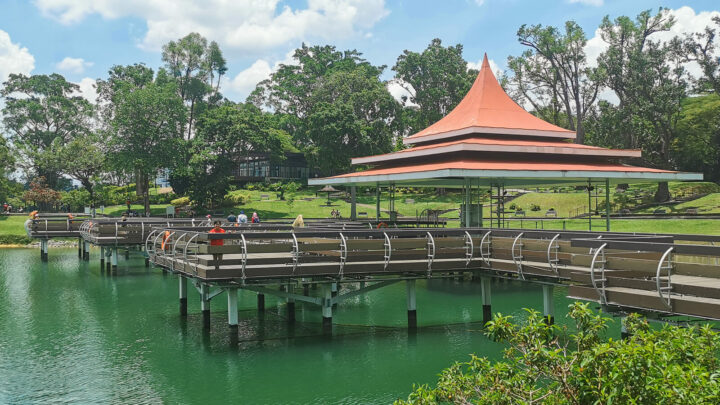
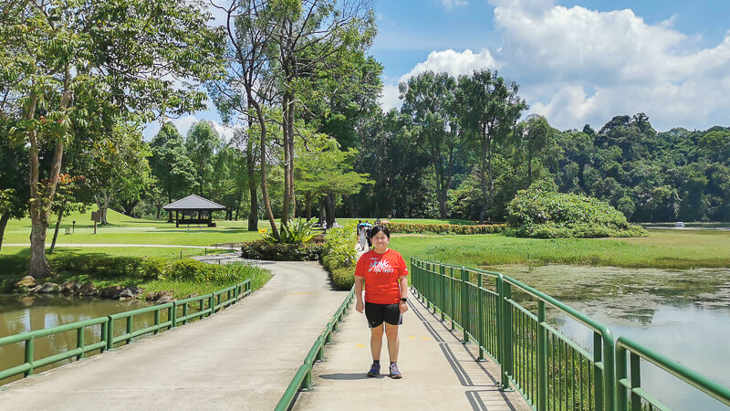
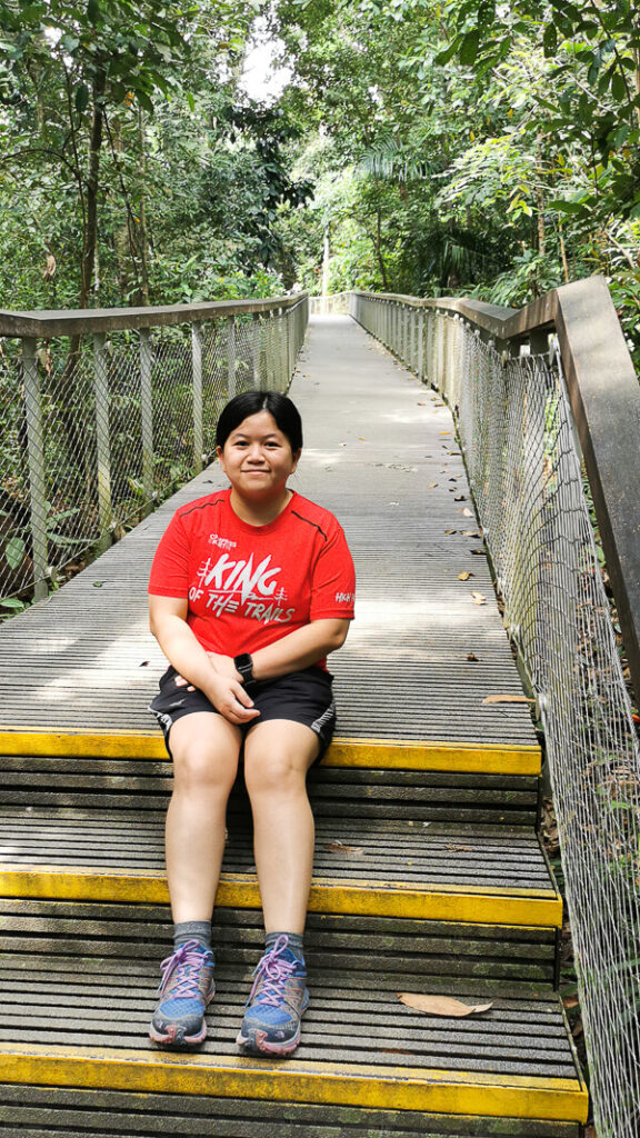
Zigzag bridge is a picturesque spot in MacRitchie, located at MacRitchie Reservoir Park, near the start of Lornie Trail. It is probably one of the Instagram-worthy places in the reservoir. You will not miss this bridge if you’re doing the entire loop of MacRitchie.
Nearby, there is an empty building which was occupied by Vava Bistro that has closed down years ago. Behind this empty building, there’s a quiet toilet nearby, use it at your own risk.
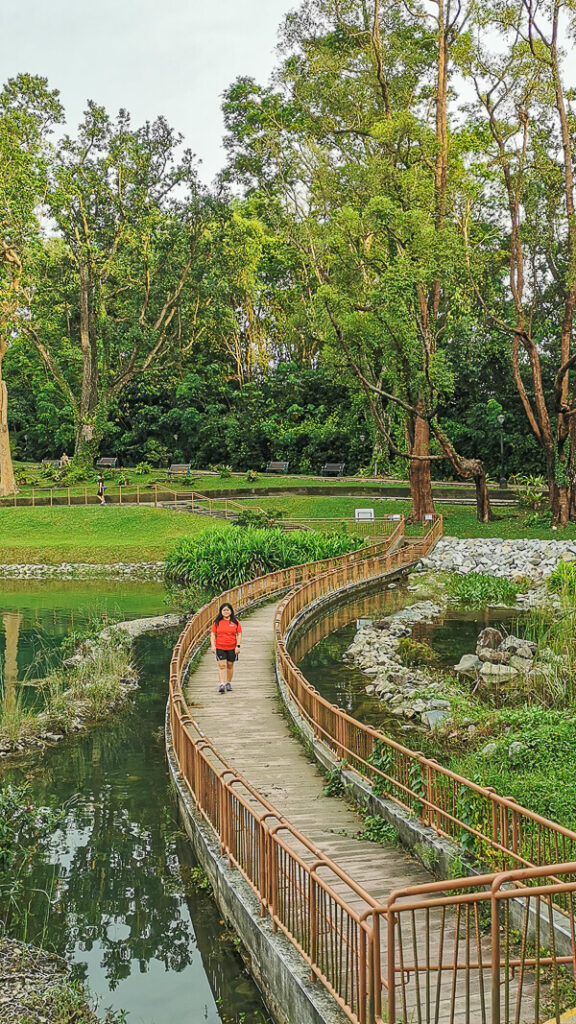
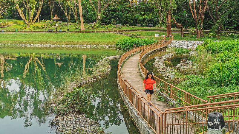
6. Walk on Submerged Boardwalk
Submerged Boardwalk bridge is less popular than the Zigzag bridge even though they’re located next to each other. During dry season, it looks just like a normal boardwalk. However, during rainy season, it transforms into a submerged boardwalk, hence the name.
This 40-meter long Submerged Boardwalk is intentionally built low so that visitors can enjoy walking through the supposedly clean and filtered water of the reservoir. The Submerged Boardwalk is open regardless of whether it is dry or submerged.

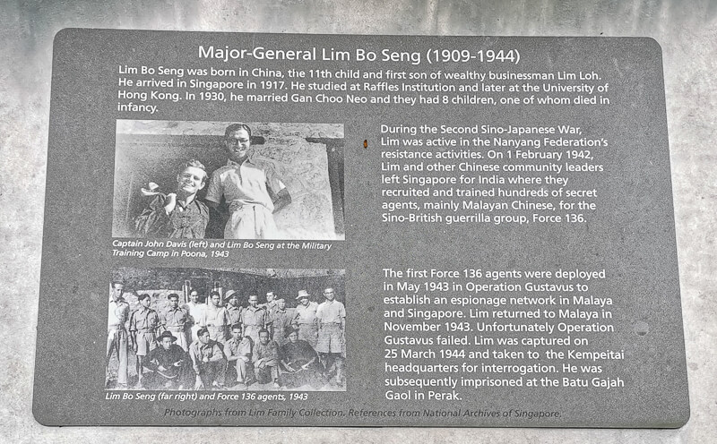
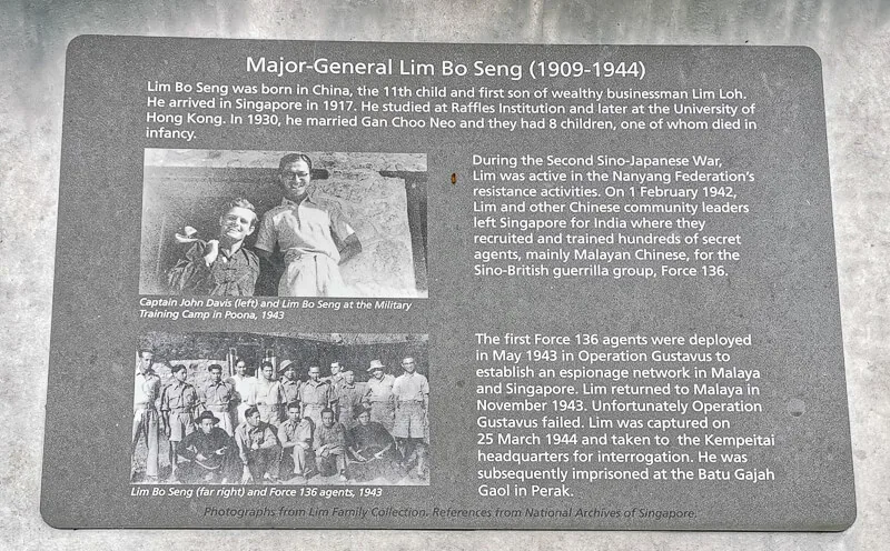
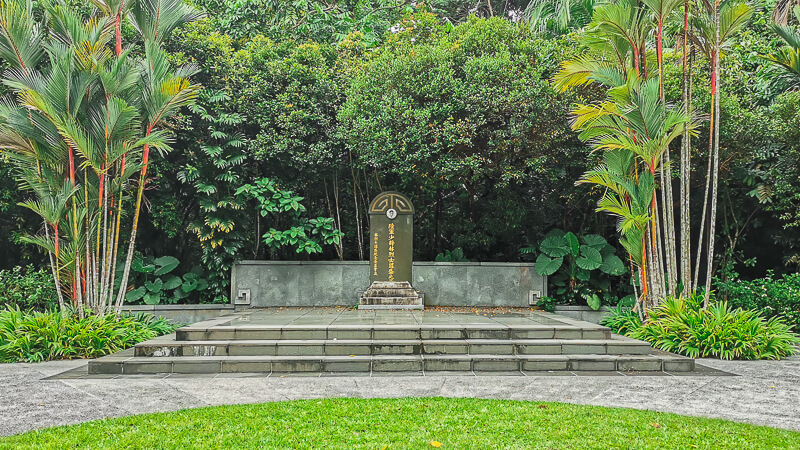
7. Pay Respect at Lim Bo Seng Memorial Tomb
Located at the elevated ground near Zigzag Bridge is the memorial tomb of Lim Bo Seng, an anti-Japanese activist during the World War 2. He was an agent of Force 136, an organisation that aims to spy on Japanese activities in Malaya. He was deployed to Malaya in November 1943, and later captured in March 1944 and died in June 1944.

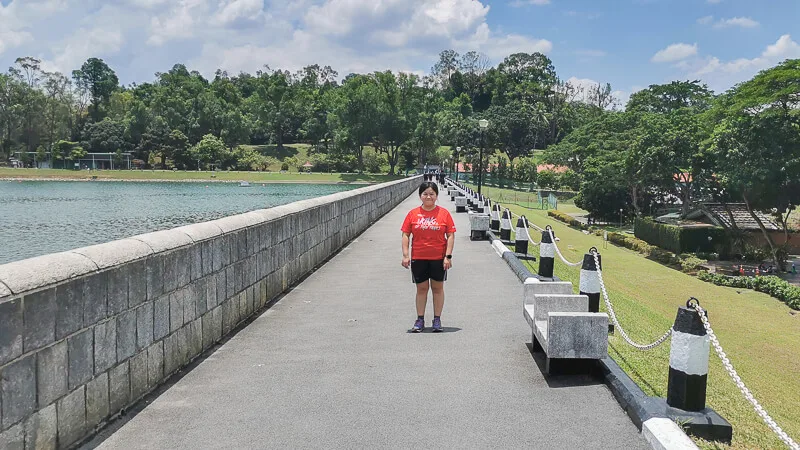
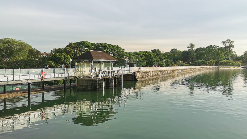
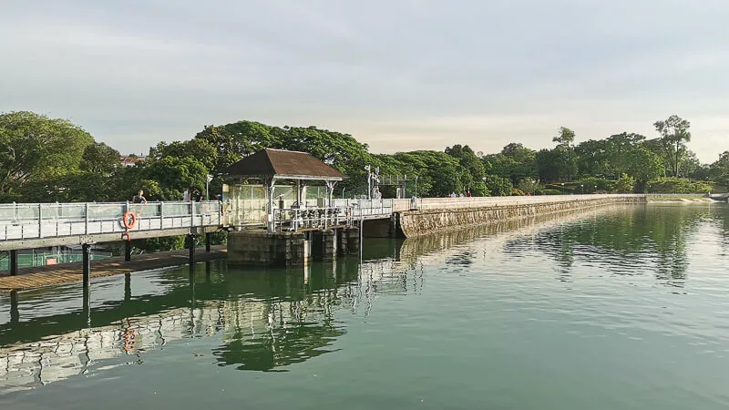
8. Walk along the Promenade
Fancy looking into the reservoir while getting lost in deep thought? The Promenade is probably the best spot to do it, during a cloudy day of course.
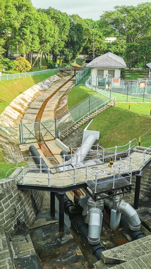
Located at MacRitchie Reservoir Park, the Promenade is a walkway right on top of the concrete dam that holds the water in the reservoir. The walkway is about 300 meter in length, and is not sheltered. It’s an Instagram-worthy spot if you’re lucky enough to have the entire promenade to yourself.


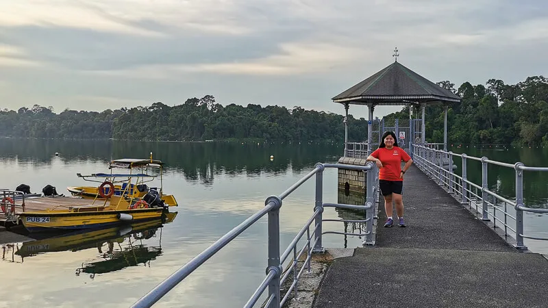
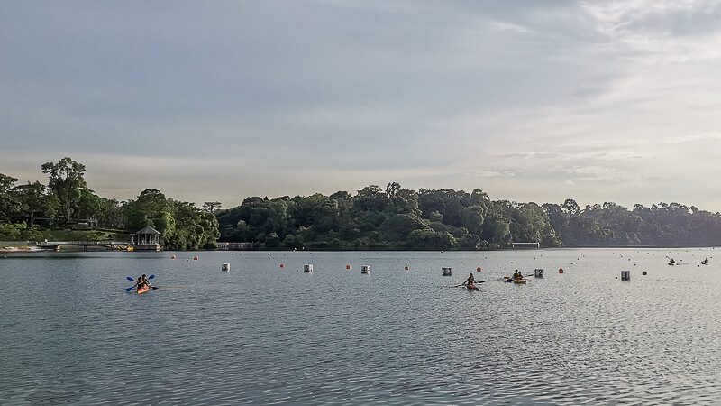
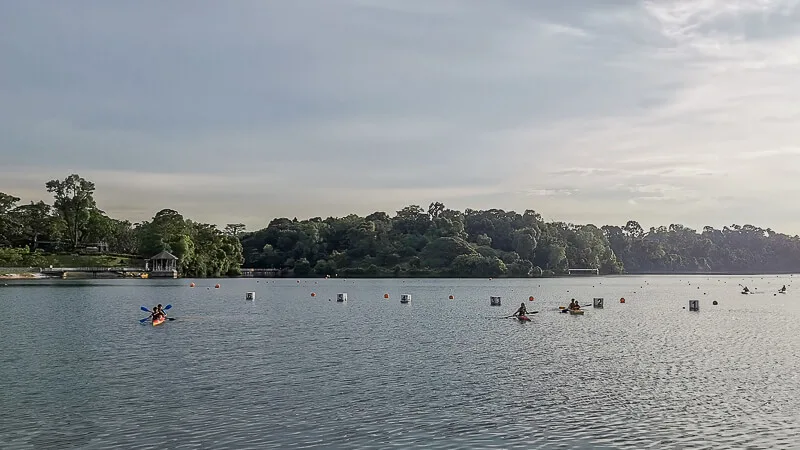
9. Kayaking
For water sport lovers, kayaking in a tranquil reservoir is something that you don’t want to miss. Paddle Lodge @ MacRitchie Reservoir provides kayak rental for both beginner (non-certified) as well as certified paddlers.
Advance booking is a MUST, so don’t turn up and expect you can immediately get on a kayak without prior booking.
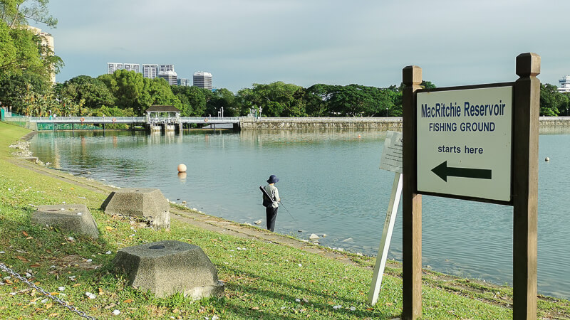
10. Fishing
Fishing is allowed at MacRitchie Reservoir, but only at designated locations. As at time of writing, there’s only 1 designated fishing location. It is the stretch between Paddle Lodge and Promenade (concrete dam).
There are no fishing gears rental at MacRitchie, so you’ll need to bring your own gears if you’re planning to fish there.

11. Mushroom Cafe
Mushroom Cafe is the only food establishment in MacRitchie Reservoir, at the time of writing. It is located near the entrance of MacRitchie Reservoir Park. The check the latest opening hours, you can visit their FB page.
Mushroom Cafe is a Halal food stall that sells local food, such as nasi lemak, laksa, curry chicken and chicken chop. The prices of main dish start from SGD 4.90. It is a great place to fuel up before or after your workout.
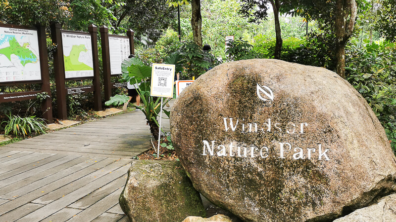
12. Windsor Nature Park
Windsor Nature Park is a small park located near Venus Drive entrance. It is comparably less crowded than MacRitchie Reservoir Park, so it’s a go-to place for people who prefer to stay away from the crowd.
There are a couple of easy trails in Windsor Nature Park:
- Hanguana Trail (350m)
- Squirrel Trail (350m)
- Drongo Trails (600m)
- Venus Loop (1.5km)

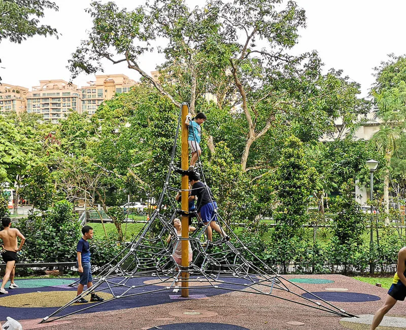
13. Do a rope challenge
Near Mushroom Cafe, there is a mini rope course that kids might find interesting.

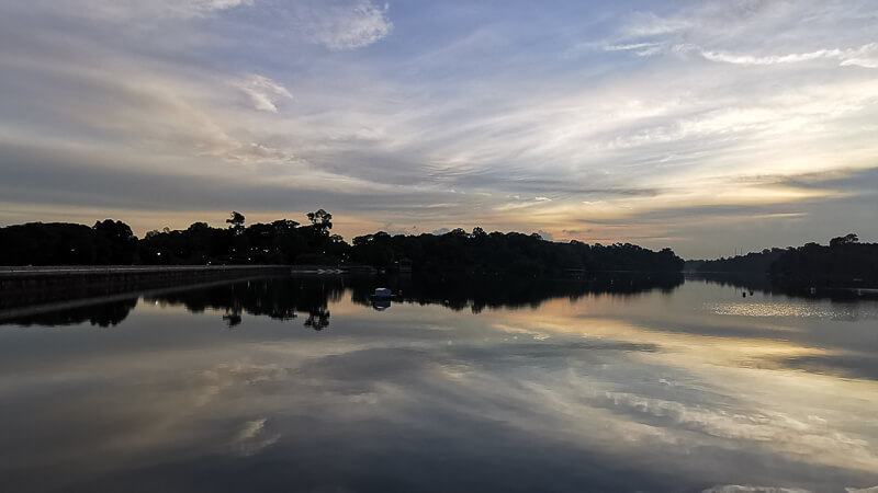
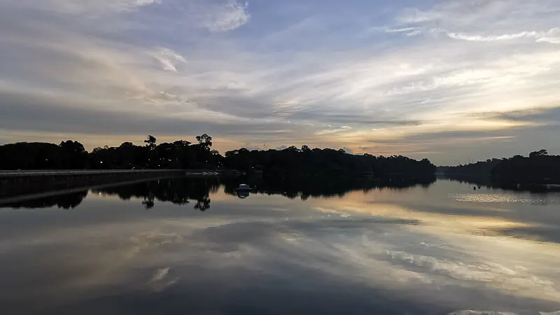
14. Watch Sunset
If you’re lucky, you might catch a spectacular sunset at MacRitchie Reservoir. The photo below is what we saw during one of our visits. It was taken after the golden hour, and I love how clear the sky is and how dramatic the clouds are.
9. WHAT NOT TO DO IN MACRITCHIE RESERVOIR
I’ve written an in-depth section about what to do in MacRitchie Reservoir. Now, I’ll continue with another important section about what NOT to do in MacRitchie.
DO NOT carry plastic bags with food. I’ve seen plenty of instances where visitors get attacked by monkeys because of food in plastic bag. If you want to bring food, keep them in your bag, not in plastic bag.
DO NOT remain in the park after sunset or before sunrise. The park is open from 7am to 7pm. Even though there’s no physical gate to prevent people from entering during night time, I really recommend not going in the park outside 7am-7pm for your own safety.
DO NOT feed the animals. Yes, they are cute, but they are not your pets.
DO NOT leave your rubbish on the trails. They belong to rubbish bin.
DO NOT cycle or scooter in the trails. These trails are for walkers and runners, not cyclist.
DO NOT be loud. Turn off your music players.
DO NOT fish at non-designated fishing location. Stick with the designated fishing location, which is near Paddle Lodge.
10. NEARBY PARKS
If you want to combine your visit with other parks, here are some parks located nearby MacRitchie Reservoir:
- Windsor Nature Park. Located near the Venus Drive entrance of MacRitchie.
- Lower Peirce Reservoir Park. Located about 1.5 km from Venus Drive entrance of MacRitchie, Lower Peirce Reservoir Park is a small park with a trail along the reservoir edge.
- Bishan-Ang Mo Kio Park. Located about 1 km from Venus Drive entrance of MacRitchie, Bishan-AMK Park comprises of actually 2 equally-beautiful parks with well-paved running paths, beautiful river and plenty of floras. It is one of my favorite places to run in Singapore.
- Bukit Timah Nature Reserve. Bukit Timah Nature Reserve is home to Singapore’s highest peak, the Bukit Timah Hill. The entire distance from venus Drive to Bukit Timah Hill summit point is about 9 km.
11. NEARBY FOOD
If you’d like more food options after your visit to MacRitchie, you can take bus (52, 132, 162, 165, 166, 167, 855, 980) from MacRitchie Reservoir and alight 3 stops later at “Bef Thomson Ridge” bus stop, where you’ll find a wide variety of restaurants. My personal favorites are Roti Prata House, Soi 19+ and Beach Road Scissor Cut Curry Rice.
Another nearby food option would be Thomson Plaza, which you can reach by taking bus (52, 132, 162, 165, 166, 167, 855, 980) from MacRitchie Reservoir and alight 4 stops later at “Bef Thomson Plaza” bus stop. My personal favorites in Thomson Plaza are Omote and Tingkat PeraMakan.
12. FAQ
How long does it take to walk around MacRitchie reservoir? It takes around 3 to 4 hours to walk the entire loop of MacRitchie Reservoir.
When is the best time to visit MacRitchie Reservoir? If you’re going into the trails, I feel that anytime is fine because most of the trails are shaded (except Golf Link).
Want to be the first to know whenever I post new articles and videos? Join my Telegram Channel and you’ll get new post alerts sent directly to your phone.
If you like my work, you can buy me a coffee! Your support will help me to keep going!
Jenny
Wednesday 6th of March 2024
Hello! We are in May the second time im Singapore and we would like to Go the first time to MacRitchie.
We are thinking about, If it's possible to start im MacRitchie Park walk around to the TreeTop and finished the trail on Venus Drive?
If yes, what do you think, how long we need for that?
Your Blog ist very awesome!
Eva
Tuesday 12th of March 2024
Hi Jenny, unfortunately the Tree Top is not accessible by vehicle, you have to start from Venus Drive or MacRitchie Park, and walk all the way to the Tree Top. For me, when I run, I need at least 1 hour from Venus Drive to Tree Top and back to Venus Drive. By walking, I think I’d need at least 2 hours. Hope you enjoy visiting MacRitchie and Tree Top :)
Patrick Lee
Monday 24th of October 2022
Hi. Does anyone know if you can access MacRitchie Reservoir on foot via Island Club Road?
Patrick Lee
Tuesday 25th of October 2022
@Eva, thanks. I'll check it out next week and report back here.
Eva
Tuesday 25th of October 2022
I haven't personally tried that. It looks like the road is quite narrow and there's no pedestrian walkway.