
As an avid runner staying in Singapore, I’m quite content with the number of running places in this tiny red dot. There are at least 60 parks around the island, a handful of reservoirs and several hills.
Not every park is good for running, though. Certain parks are minuscule and you wonder why they’re called a park at all.
In this post, I’ll be sharing the running places that are great for running. Some of these places are my personal favorites. Some are my go-to places to train for a marathon. In some, you can hardly see a tall building, and you wonder if you’re still in Singapore.
Please bear in mind that this list is highly subjective because I curate this based on my personal experience. As with other articles on this blog, I only write about places that I have personally visited.
I try to sort these places in a clockwise direction according to their locations on the map, but it’s really tough because they’re scattered all over the place. Anyway, I’ve included the links to Google Maps so that you can know their exact location.
Without further ado, here are the 22 best places to run in Singapore (for free) that you don’t want to miss.
Table of Contents
1. Sentosa
Have any questions about traveling in Singapore? Join All About Singapore Travel FB group, I'll be there to answer your questions!
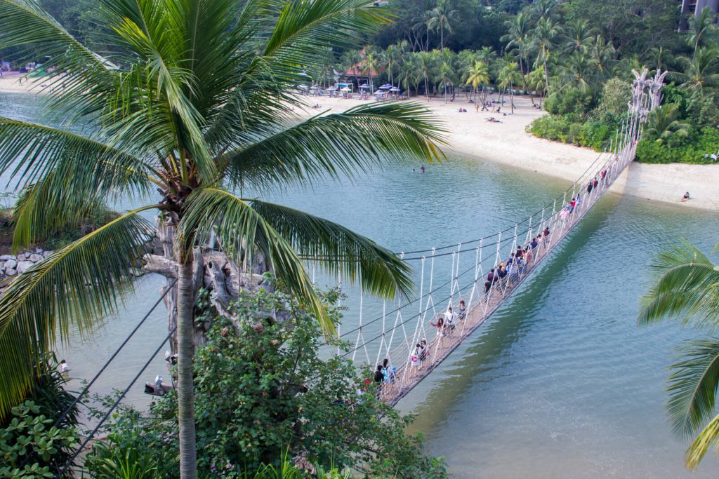
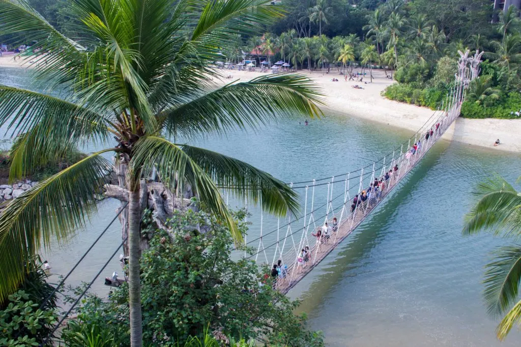
Yes, Sentosa is a popular tourist attraction in Singapore. If you don’t know yet, Sentosa has several running and cycling trails, such as Sentosa Walk (which connects VivoCity and Imbiah Station), Imbiah Trail (which connects Imbiah Station and Siloso Point), Beach Trail (which runs along Siloso, Palawan and Tanjong Beach), Coastal Trail and Mt Imbiah Nature Trail.
It can be quite difficult to run at Sentosa on weekends because of the crowd, so I recommend that you run early in the morning.
How to go: Take MRT to Harbourfront Station.
Opening hours: 24 hours daily.
Location on Google Maps: https://goo.gl/maps/tSHxYti4yhwz5ZxT9
Maps of Sentosa Trails: https://www.sentosa.com.sg/en/get-inspired/sentosa-discovery-guide/
2. Southern Ridges
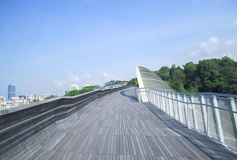
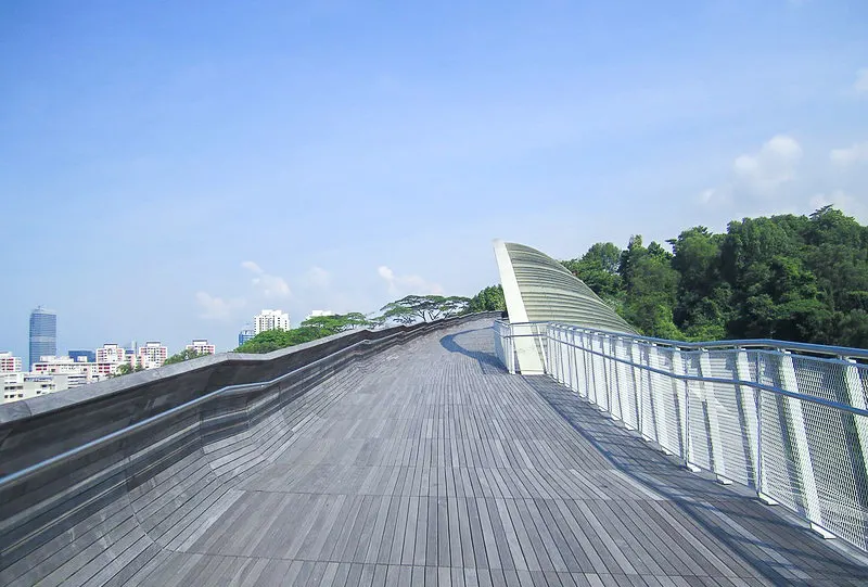
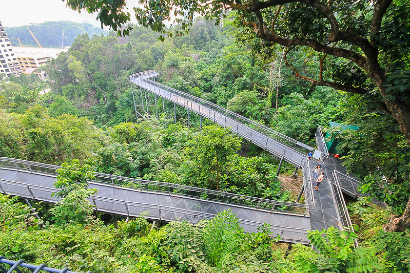

The Southern Ridges is one of the most popular running & cycling trails at the southern part of Singapore. It consists of 5 parks, namely Kent Ridge Park, Hort Park, Labrador Nature Reserve, Telok Blangah Hill Park and Mount Faber Park.
There are 2 recommended routes by NParks. The first route starts from Harbourfront MRT and ends at Kent Ridge Park, passing through Mount Faber Park, Telok Blangah Hill Park, HortPark and Kent Ridge Park. The total distance is about 5.2km.
The second route starts from Harbourfront MRT and ends at Labrador Nature Reserve. At Alexandra Road, instead of going straight to HortPark, turn left to Labrador Naure Reserve. the total distance is about 4.5km.
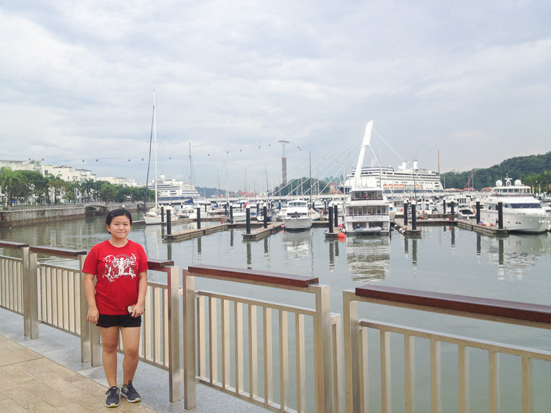
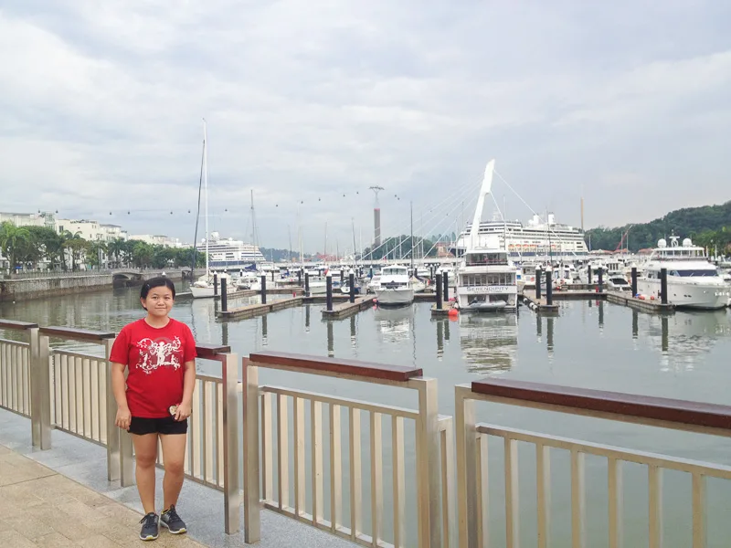
Personally I prefer the second route because I love ending my run at Keppel Bay, watching luxurious yachts and daydreaming about the day I can afford to sail on a yacht.
If you are staying near the city center, I highly recommend that you run at Southern Ridges because there are so many scenic views along the way.
How to go: Take MRT to Harbourfront Station.
Opening hours: 24 hours daily.
Location on Google Maps: https://goo.gl/maps/GkCWjbnwHcVF7ribA
More info on NParks’ site: https://www.nparks.gov.sg/gardens-parks-and-nature/parks-and-nature-reserves/the-southern-ridges
Maps of Southern Ridges: https://www.nparks.gov.sg/~/media/nparks-real-content/gardens-parks-and-nature/diy-walk/diy-walk-pdf-files/hortpark-and-southern-ridges.pdf
3. West Coast Park
The West Coast Park is a secluded park located at the southwest of Singapore. Even though it is at the west coast, it’s unlikely that you get unobstructed view of the sunset because there’s a port just off the coast, so you can expect sunset-with-cargo-ships kind of view.
West Coast Park is a favorite place not only for runners, but also families thanks to the comprehensive playgrounds, barbecue pits, camping areas as well as a kite-flying field.
One loop around west coast park is approximately 5km long. Due to the sheer size of the crowd, WCP is not a great place for speed work. It is more suitable for easy runs.
How to go: Take MRT to Haw Par Villa Station then head west for 1km.
Opening hours: 24 hours daily
Location on Google Maps: https://goo.gl/maps/5MVwjuj9GvojAi6j9
More info on NParks’ site: https://www.nparks.gov.sg/gardens-parks-and-nature/parks-and-nature-reserves/west-coast-park
4. Jurong Lake Gardens
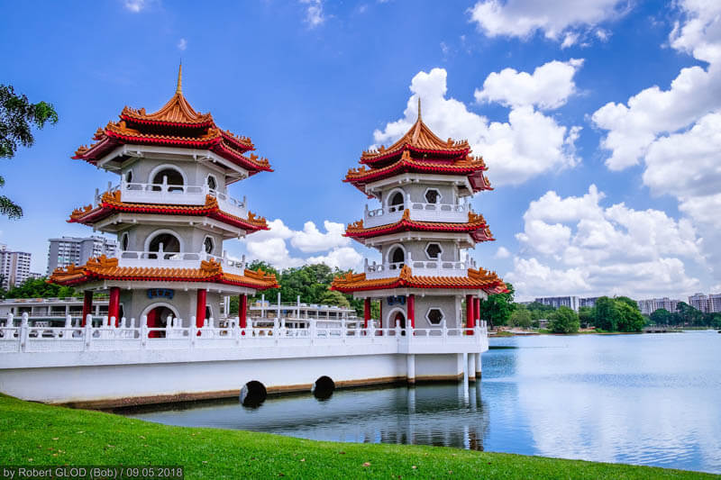
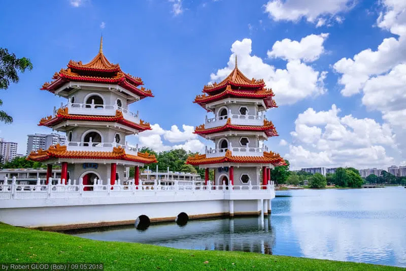
In the past, Jurong Lake Gardens consisted of only Chinese Garden and Japanese Garden. In 2019, the park saw the addition of brand new nature trails, Lakeside Garden, Alstonia Island, playground, dog run and water sport facilities, making it a perfect park for families, joggers and cyclists.
The distance from the north of the garden to the south is approximately 3.5km excluding Chinese Garden and Japanese Garden (both are currently under construction and will be re-opened in 2021). By adding those two gardens, you can easily clock 6km.
Towards the south part of the lake, there is a sport facility called ActiveSG which has a swimming pool and gym. So, if you’d like to dip in a pool after your run, you know where to go!
How to go: Take MRT to Lakeside Station.
Opening hours: Trails are open 24 hours daily, attractions have their own operating hours
Location on Google Maps: https://goo.gl/maps/tbnk3YHXKMG1oc1G7
More info on NParks’ site: https://www.nparks.gov.sg/juronglakegardens
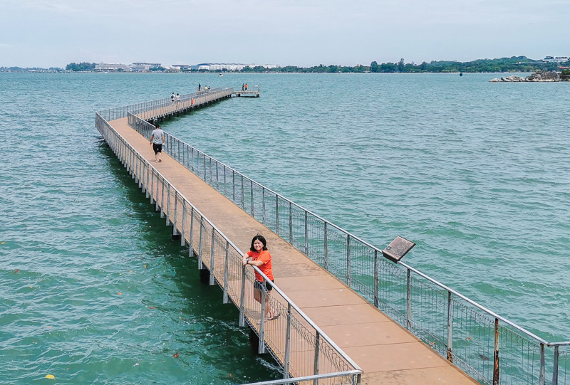
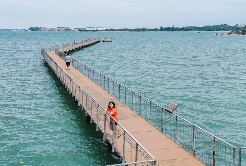
5. Sungei Buloh Wetland Reserve

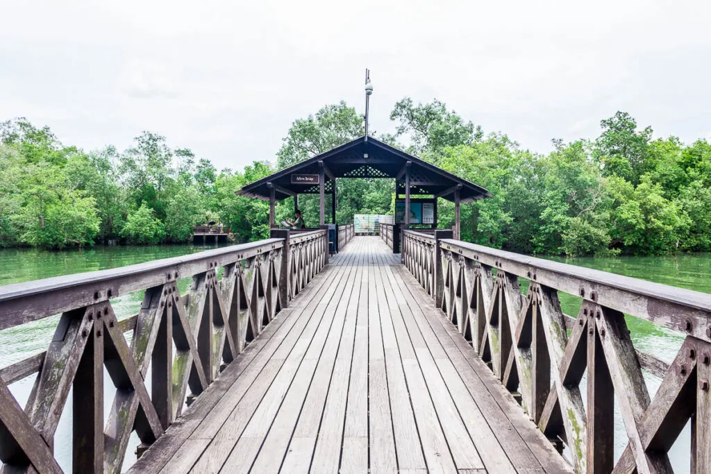
Sungei Buloh Wetland Reserve is a 200-hectare nature park filled with extensive wetlands and rich biodiversity. Located at the northwest of Singapore, the park has a couple of walking trails, namely Migratory Bird Trail (1.95km loop), Mangrove Boardwalk (500m), Coastal Trail (1.3km), Forest Trail (300m) and Mid-Canopy Walk (150m).
Sungei Buloh is the perfect place for adventurers who are keen to explore the park and appreciate the biodiversity while burning off calories at the same time. The park is really huge, and if you’re just walking, 1 day is not enough the explore the entire park.
I should also highlight that Sungei Buloh is more suited for recreational runners, not ambitious runners. The trails are walking trails, hence you can expect plenty of bottlenecks and you might need to slow down frequently.
Address:
Visitor Centre (nearer to Migratory Bird Trail): 301 Neo Tiew Crescent Singapore 718925;
Wetland Centre (nearer to Forest Trail and Mid-Canopy Walk): 60 Kranji Way, #01-00 Singapore 739453
How to go: Take Kranji Farms Shuttle Bus from Kranji MRT Station
Opening hours: 7 am to 7 pm daily
Location on Google Maps: https://goo.gl/maps/xc1hP5qdh93DRPQFA
More info on NParks’ site: https://www.nparks.gov.sg/gardens-parks-and-nature/parks-and-nature-reserves/sungei-buloh-wetland-reserve
6. Admiralty Park – Woodlands Waterfront Park
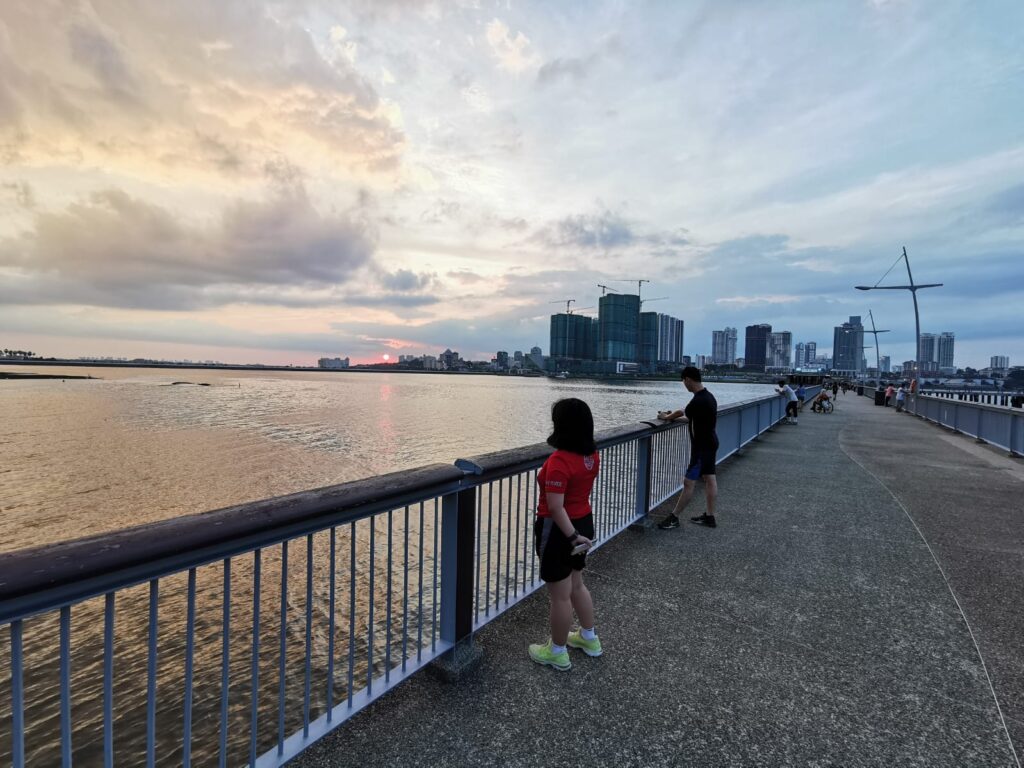
Admiralty Park and Woodlands Waterfront Park are two separate parks located just across the street from one another. I combined these 2 parks together because visiting just one of the parks feels incomplete.
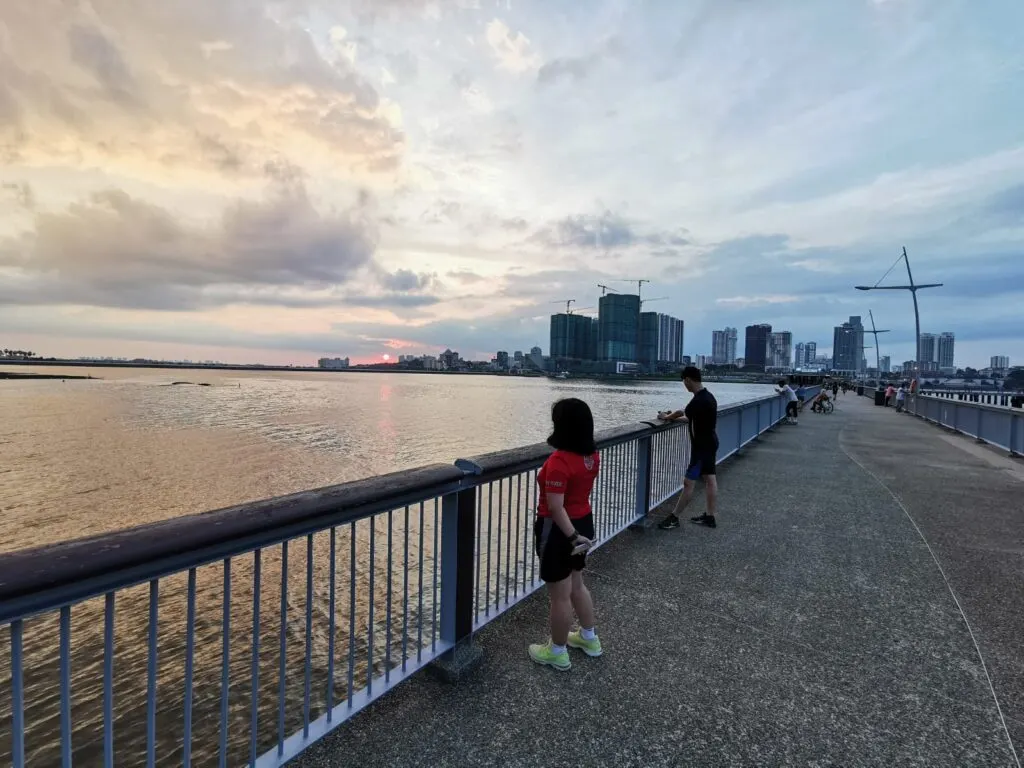
Woodlands Waterfront Park is one of the few places where you can see Malaysia from Singapore without using any binoculars! I’d even argue that this park is the best place to see Johor Bahru’s skyline. And a sunset!
Woodlands Waterfront Park is not exactly big, it’s only 700m from the west end to the east end. Hence, I recommend that you also run in Admiralty Park, which has 1.5km running path.
How to go: Take MRT to Woodlands Station, then run 900m to Admiralty Park. Run through Admiralty Park towards the north for 1.5km and you’ll arrive at Woodlands Waterfront Park.
Opening hours: 24 hours daily, but I don’t recommend running at night because there’s no light at the forested area.
Location on Google Maps: https://goo.gl/maps/eAg62r8Qi3VGgxY97 and https://goo.gl/maps/uaGLEwykmw585V9e6
More info on NParks’ site: https://www.nparks.gov.sg/gardens-parks-and-nature/parks-and-nature-reserves/admiralty-park and https://www.nparks.gov.sg/gardens-parks-and-nature/parks-and-nature-reserves/woodlands-waterfront-park
7. Bukit Timah Nature Reserve
Bukit Timah Nature Reserve is home to the country’s highest point called Bukit Timah Hill, which stands at 163m. Not impressive compared to other countries, I know. A fit person may be able to scale the hill easily. But, for someone with mediocre fitness like me, scaling the summit in this brutal tropical heat is an impressive feat.
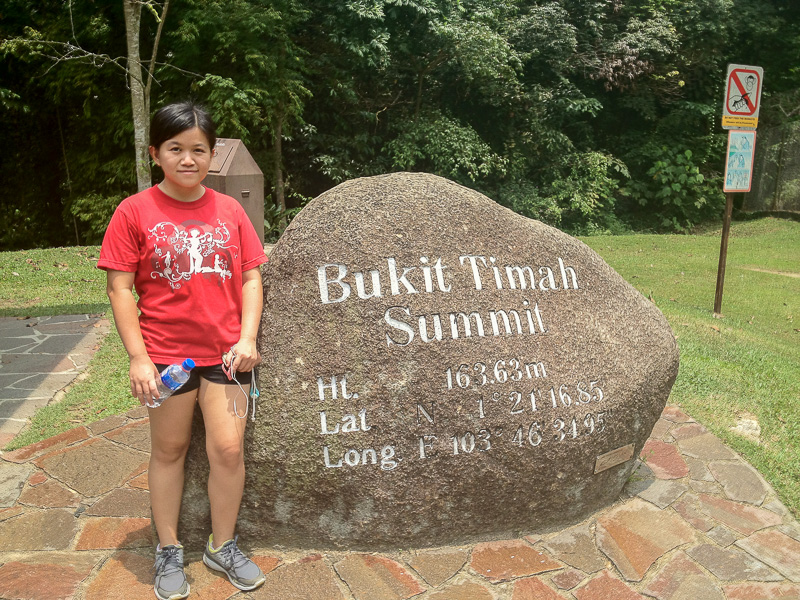

Even though it is the highest peak on this island, don’t expect breathtaking view at the top. You’re in the middle of a forest after all. What you can expect, though, is the feeling like you’re deep in the jungle without any sight of high-rise building. If you’re lucky, you might meet some monkeys. Do not feed or play with them, and keep your loose items secure (eg: keep your plastic bags, water bottle, handphone, specs).
If you’re planning to run at Bukit Timah Nature Reserve, I recommend that you start your run from Bukit Batok Town Park (Little Guilin) where you get to admire the beauty of the granite rock formation that resembles those at Guilin in China, then run eastward to Bukit Batok Nature Park where you can get stunning view of a quarry at the Lookout Point. From here, Bukit Timah Nature Reserve is just 1.5km away.
For long-distance runners, if you need to clock more mileage, I recommend that you continue your run from Bukit Timah Nature Reserve to MacRitchie Reservoir by running along Rifle Range Road.
There are plenty of signs directing you to MacRitchie so don’t worry about getting lost. The distance between Bukit Timah Nature Reserve and MacRitchie is about 10km. PS: MacRitchie is one of my favorite trails in Singapore and I’ll tell you why, later in this article.
How to go: Take MRT to Beauty World Station and run for 800m.
Opening hours: 7am to 7pm daily
Location on Google Maps: https://goo.gl/maps/gntsmsk25PFdwA5w7
More info on NParks’ site: https://www.nparks.gov.sg/gardens-parks-and-nature/parks-and-nature-reserves/bukit-timah-nature-reserve.
8. MacRitchie Reservoir


MacRitchie Reservoir is one of the best trails in Singapore, hands down! There was a period in my life when I would obsessively go to MacRitchie to train for a marathon.
My preferred route is the entire loop of 10km, starting and ending at Mushroom Cafe. However, on certain curious days, I would hike up to the TreeTop Walk to take in the incredible view of forest the canopy.
On really rare days when I needed to clock higher mileage, I would start at Mushroom Cafe, run past the Golf Link towards Jelutong Tower, then take a left turn to Rifle Range Road and headed to Bukit Timah Nature Reserve.
What makes MacRitchie a good trail? I would say it’s the combination of rugged terrains, tranquil reservoir, dense foliage (you can run at noon and still covered by shades at most part of the trail), surprise encounter with wildlife (like monkeys, monitor lizard, as well as snake if you’re as lucky as me!).
Honestly I can go on and on about how much I love MacRitchie but I guess that’s for another post.
Before you visit MacRitchie, read my detailed guide for visiting MacRitchie Reservoir.
How to go: Take MRT to Caldecott Station and run for 1km.
Opening hours: 24 hours daily, but I suggest you avoid running in the dark
Location on Google Maps: https://goo.gl/maps/VzCWHbpCCLsnMjqx6
More info on NParks’ site: https://www.nparks.gov.sg/gardens-parks-and-nature/parks-and-nature-reserves/central-catchment-nature-reserve
9. Bishan – Ang Mo Kio Park

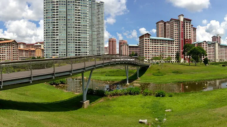
I used to stay at Ang Mo Kio for 5 years, so, naturally I had to find a place to feed my hunger for running. The best place to run in AMK is undoubtedly the Bishan – Ang Mo Kio Park. It has great scenery, toilet, water fountain, vending machine and half of the park is shaded.
There are 2 different parks, separated by Ang Mo Kio Avenue 6. The west park is longer (about 3.5km a loop), while the east park is smaller (about 2.5km a loop). Both parks have water fountain, so you don’t have to carry your own bottle.
There’s a McDonald’s at the east park, which is a cruel temptation for people trying to lose weight by running.
I would argue that Bishan-Ang Mo Kio Park is the perfect place for all running distances. Need an easy run? Just run a loop. Need 5K? Two loops then. Need 21K? It’s 6 loops at the west park, or 8 loops at the east park. Darn, I miss staying at AMK!
How to go: Take MRT to Bishan or Ang Mo Kio Station and run for 1km.
Opening hours: 24 hours daily
Location on Google Maps: https://goo.gl/maps/SLrsLJdkXupjEg5F9
More info on NParks’ site: https://www.nparks.gov.sg/gardens-parks-and-nature/parks-and-nature-reserves/bishan—ang-mo-kio-park
10. Punggol Waterway Park

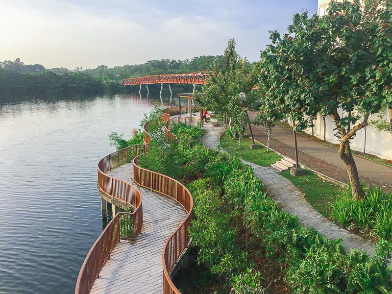
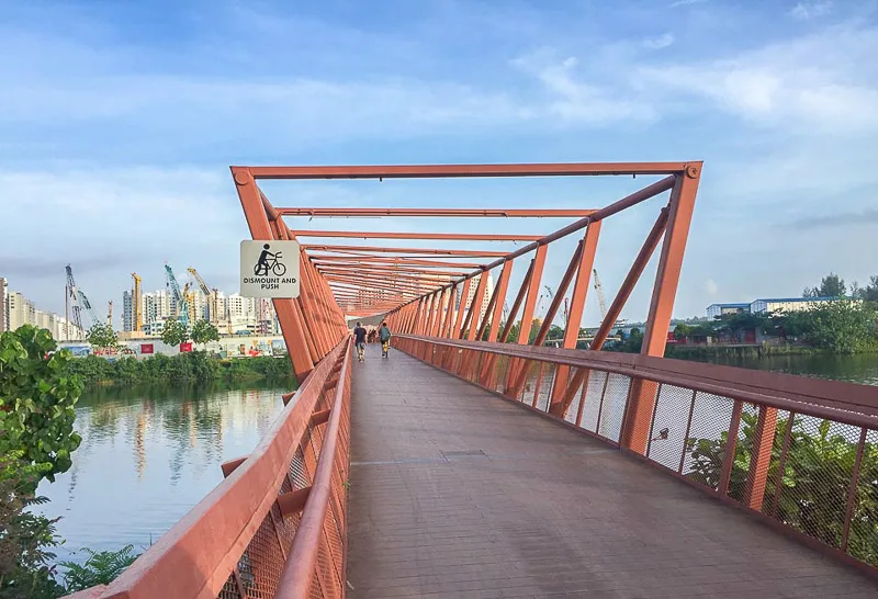
Technically, Punggol Waterway Park is a 4.2km park along the waterway that cuts through Punggol Town, at the northeast of Singapore. It is part of the North Eastern Riverine Loop and it’s also one of my most favorite trails in Singapore.
There are 5 beautiful bridges along this park, namely Jewel Bridge, Adventure Bridge, Kelong Bridge, Wave Bridge and Sunset Bridge. My favorite bridges have to be Sunset Bridge and Jewel Bridge. The views from the bridge are worth pausing my run.
Due to its proximity to Lorong Halus and Punggol Settlement, I recommend that you visit these two places if you’re running at Punggol Waterway Park.

Whenever I needed to clock more mileage, I would continue my run to Punggol Promenade Nature Walk (tarmac) and Coney Island (trails). I’ll talk about Coney Island more in the next section.
How to go: Take MRT to Punggol Station.
Opening hours: 24 hours daily
Location on Google Maps: https://goo.gl/maps/qScFGb2cR46NHZ8K6
More info on NParks’ site: https://www.nparks.gov.sg/gardens-parks-and-nature/parks-and-nature-reserves/punggol-waterway-park
11. Coney Island
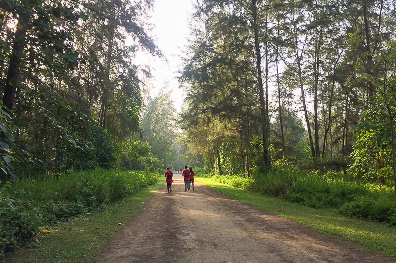
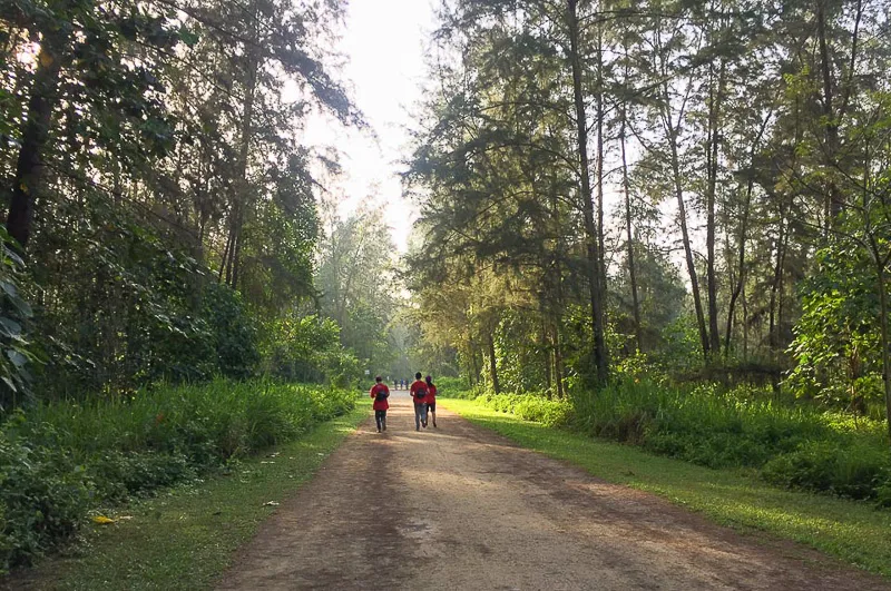
Coney Island, also known as Serangoon Island, is an underrated island (aka hidden gem) located off the northeast coast of Singapore.
There are 2 entrances, west entrance (near Punggol Settlement) and east entrance (near Lorong Halus jetty). The west entrance is more popular because it is nearer to civilization compared to its sister entrance.
The island is quite hard to get to because there isn’t an MRT or LRT station within its walking distance. I guess that’s what put people off from visiting the island. And that’s good for runners, because we’ll get to run without bumping into crowds.
The facilities are quite minimal on the island. There’s only 1 toilet and there’s no running water and electricity on the island. There are only a few huts, so avoid running there during rainy season. Bring your own water and apply insect repellent.
The distance from west entrance to east entrance is about 2.4km. There’s 1 main path that cut across the island. However, I recommend that you take a detour to the beaches to catch a glimpse of Pulau Ubin (another island of Singapore) and Pasir Gudang (part of Johor, Malaysia).
How’s the trail in Coney Island like? It’s rustic! It’s nothing like other places in Singapore (well, except Pulau Ubin). Nature lovers are going to love it. I highly recommend that you run here if you love running in quiet forest.
How to go: Take MRT to Punggol Station, then LRT to Punggol Point, then run for 1.8km.
Opening hours: 7am to 7pm (make sure you go out before 7pm because the gates will be locked at 7pm and who knows what animals are there)
Location on Google Maps: https://goo.gl/maps/QMA6pSXaYTnU7EZL7
More info on NParks’ site: https://www.nparks.gov.sg/gardens-parks-and-nature/parks-and-nature-reserves/coney-island-park
12. Pasir Ris Park

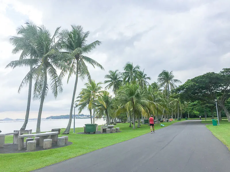
Stretching over 3.2km along the northeast shore, Pasir Ris Park doesn’t lack of serene scenery, salty air and laughter of families. It even has Mangrove Boardwalk and Maze Garden!
Most park goers enjoy playing at the playground, barbecuing with friends, skating, cycling and running. Camping is also permitted here.
With such a big variety of activities, one should expect the park to be crowded. The truth is, Pasir Ris Park is not as crowded as other beach parks, like East Coast Park.
If you love to run by the beach (not on the beach) without the crowd, Pasir Ris Park is a decent place to run at, especially in the morning.
Pasir Ris Park is located right next to D’Resort @ Downtown East. So if you’re staying there, do not miss out this park.
How to go: Take MRT to Pasir Ris Station, then run for 500m.
Opening hours: 24 hours daily.
Location on Google Maps: https://goo.gl/maps/KnBNKkYEu3xSyBKu8
More info on NParks’ site: https://www.nparks.gov.sg/gardens-parks-and-nature/parks-and-nature-reserves/pasir-ris-park
13. Pulau Ubin
Pulau Ubin is one of my favorite places in Singapore. I even wrote a really comprehensive guide about Pulau Ubin.
This island is popular among locals who want to escape the bustling city of Singapore. Most visitors explore the island by cycling, meanwhile, a small percentage of visitors (me included) prefer to explore on foot.
The west part of the island is used by Outward Bound and closed for public. Only the center and east parts of the island are accessible by visitors.
The distance between Ketam Quarry (at midwest) to Chek Jawa (east) is about 5.5km. If you make a detour to the beaches at the northern part, you’ll easily clock over 10km.
It is also possible to camp overnight at the island, but you need to bring your own tent and report to the guard that you’ll be spending the night there.
How to go: Take ferry from Changi Village. Follow the steps in my detailed guide.
Opening hours: 24 hours daily, but ferry doesn’t operate at night.
Location on Google Maps: https://goo.gl/maps/mrvA3iFMg4J2qnZh6
More info on NParks’ site: https://www.nparks.gov.sg/gardens-parks-and-nature/parks-and-nature-reserves/pulau-ubin-and-chek-jawa
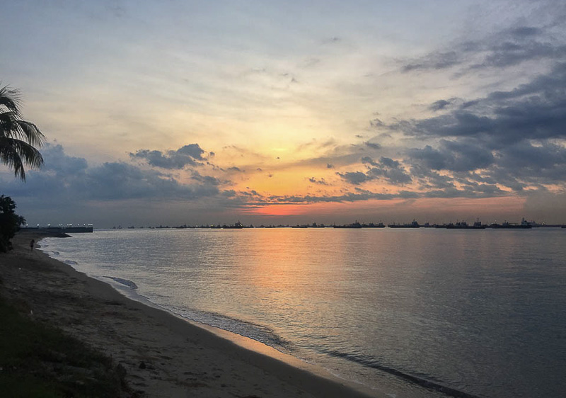
14. East Coast Park
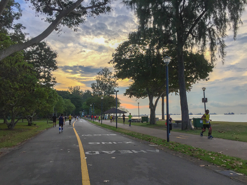

East Coast Park is probably the most popular beach park in Singapore. Hundreds of locals flock to this place on weekends. Plenty of running races take place here.
What makes East Coast Park (ECP) so popular? I guess it’s because there are so many things you can do at ECP, from camping, watching sunrise, cycling, running, water sports (sailing, surfing, SUP, and many more), barbecuing, fishing, skating, swimming to dining (plenty of seafood options and local foods).
East Coast Park probably has the longest running path along the beach in Singapore. The distance between Katong flyover to Water Venure is about 6.5km. Every Saturday at 7.30am, parkrun is happening at ECP.

If you want to run longer, you can continue your run eastward to Coastal Park Connector (it’s a 15km long running path) and end your run at Changi Village. Otherwise, from ECP you can also continue your run westward to Gardens by the Bay and Marina Bay areas.
How to go: Take MRT to Bedok Station, then take bus 401 from Bedok Interchange. Do note that this bus only operates on Saturday (2pm-10pm) and Sunday (10am-8pm). Otherwise, follow the directions on google maps.
Opening hours: 24 hours daily.
Location on Google Maps: https://goo.gl/maps/EBbmG51jLF2RUqvq5
More info on NParks’ site: https://www.nparks.gov.sg/gardens-parks-and-nature/parks-and-nature-reserves/east-coast-park
15. Bedok Reservoir Park

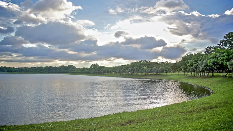
Tucked in the heartland in the east, Bedok Reservoir Park is a great place for runners who love to run near the water, but don’t wish to travel far to East Coast Park or Pasir Ris Park.
The terrain of the running trail at this park is pretty flat, thus perfect for speed training. It is also a great route for distance running. A loop around the reservoir is approximately 4.3km.
The park is especially lively on weekends when families exercise to keep fit, adventure seekers chase adrenaline at the obstacle course and zip lines, and water sport lovers sweat it out with kayaks or dragon boats.
How to go: Take MRT to Bedok Reservoir Station.
Opening hours: 24 hours daily
Location on Google Maps: https://goo.gl/maps/9jfwnv3vKCz7qED6A
More info on NParks’ site: https://www.nparks.gov.sg/gardens-parks-and-nature/parks-and-nature-reserves/bedok-reservoir-park
16. Singapore Sports Hub

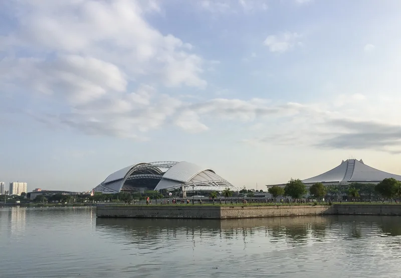
Fancy running at the iconic Singapore Sports Hub? It is possible and it’s free! It is open 24 hours a day.
This 900m running track that encircles the National Stadium is called 100Plus Promenade. It is located at the 3rd level of National Stadium.
It’s a sheltered track, so you can run in the middle of the day without worrying about the sun. However, do note that it’s not exactly rain-proof because rain can still come in from the sides.
Other than running track, the Sports Hub is home to various sport facilities. So, if you wish to play sports, do book the facilities in advance.
How to go: Take MRT to Stadium Station.
Opening hours: 100Plus Promenade is open 24 hours daily. Other facilities have their own operating hours.
Location on Google Maps: https://goo.gl/maps/P4tYtupGiGHyNBfZ9
More info about free facilities on Singapore Sports Hub: https://www.sportshub.com.sg/sport-fitness/experience-sports-sessions
17. Gardens by the Bay

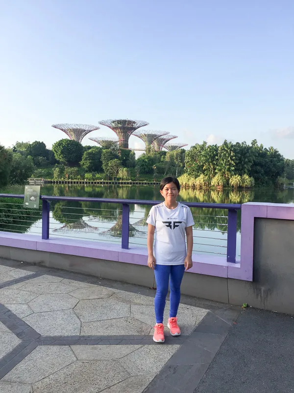
I’m sure everyone who’s been to Singapore or planning to visit Singapore is has heard about this iconic garden called Gardens by the Bay (GBTB). This popular Garden is home for the beautiful Flower Dome, Cloud Forest, Supertrees and OCBC Skyway.
Other than the main garden, GBTB also has a smaller garden called Bay East Garden, which is located across the bay from the big Garden. At the moment, there’s no attractions at Bay East, only huge green fields and a running/cycling track with unobstructed views of Singapore’s Marina Bay skyline.
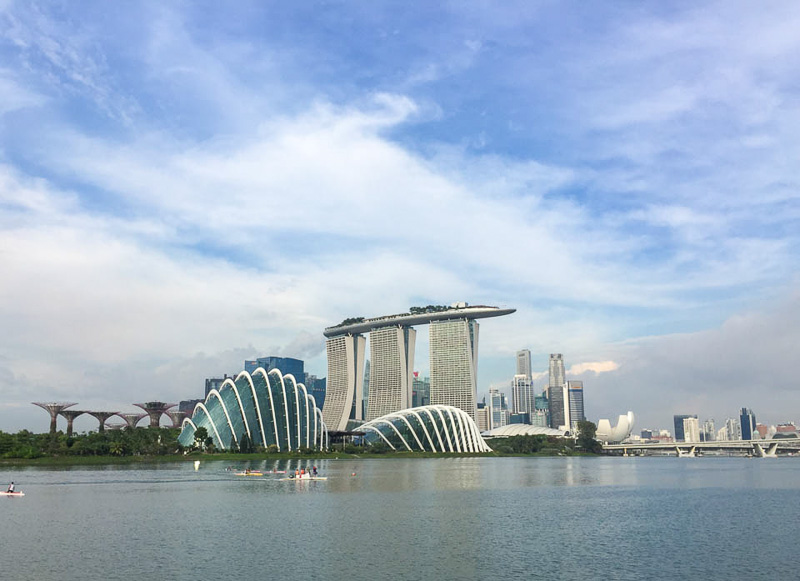

I highly recommend that you run at both the big Garden and the Bay East Garden by starting at Bayfront MRT and ending at Singapore Sports Hub. When you pass through Marina Barrage, go up to the green roof and take a moment to admire Marina Bay area.
The total distance from Bayfront MRT to Singapore Sports Hub is approximately 5.5km without detour. With detour to Supertrees and Marina Barrage, it’s about 8km to 10km. Since the entire route is not sheltered, I recommend that you run early in the morning or late in the afternoon.
How to go: Take MRT to Bayfront Station.
Opening hours: The outdoor areas are open 24 hours daily, but attractions have their own operating hours.
Location on Google Maps: https://goo.gl/maps/XYzfXiTWx8d7kVk76
More info about Gardens by the Bay: https://www.gardensbythebay.com.sg/en/attractions.html
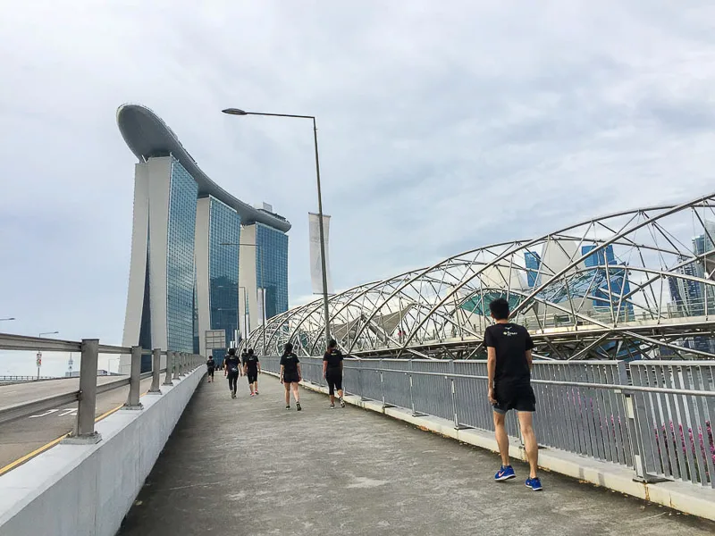
18. Marina Bay

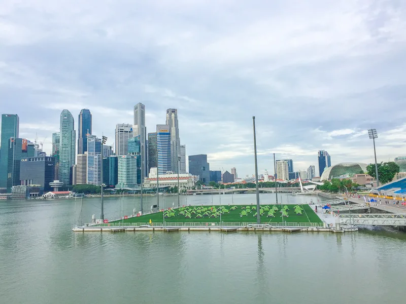
There are people who would choose to escape the city anytime they’re given a chance to, but there are also people who embrace the throbbing pulses of a busy city.
If you’re an urban lover who loves to be around high achievers, then Marina Bay is the right running place for you.
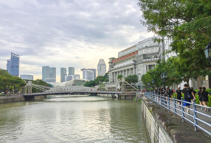
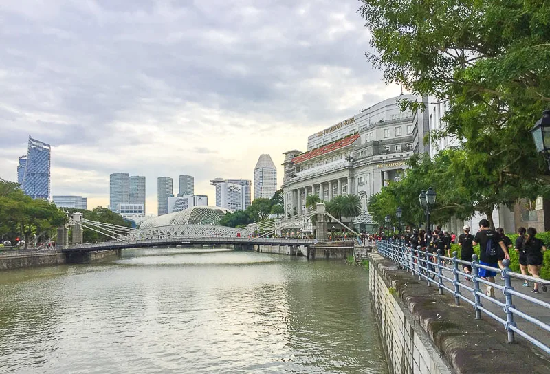
I recommend that you start your run at Boat Quay (take Exit G from Raffles Place MRT Station). From here, run along Singapore River, cross the Cavenagh Bridge to Esplanade Park, run pas the durian-shaped Esplanade, the Float @ Marina Bay, take a detour to Singapore Flyer if you want, Helix Bridge, Marina Bay Sands and end at Merlion.

The total distance of this loop is about 3.5km. If you wish to run more, you have several options: Gardens by the Bay (see point 17), Fort Canning Park (see point 19), or Singapore River (see point 20).
How to go: Take MRT to Raffles Place Station.
Opening hours: The outdoor areas are open 24 hours daily.
Recommended route on Google Maps: https://goo.gl/maps/iV8BcPs2DubsNnft9
19. Fort Canning Park
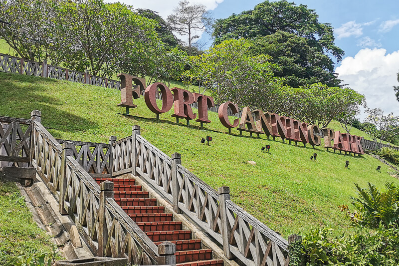
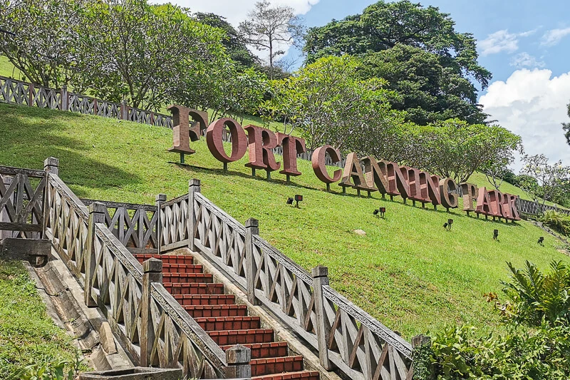
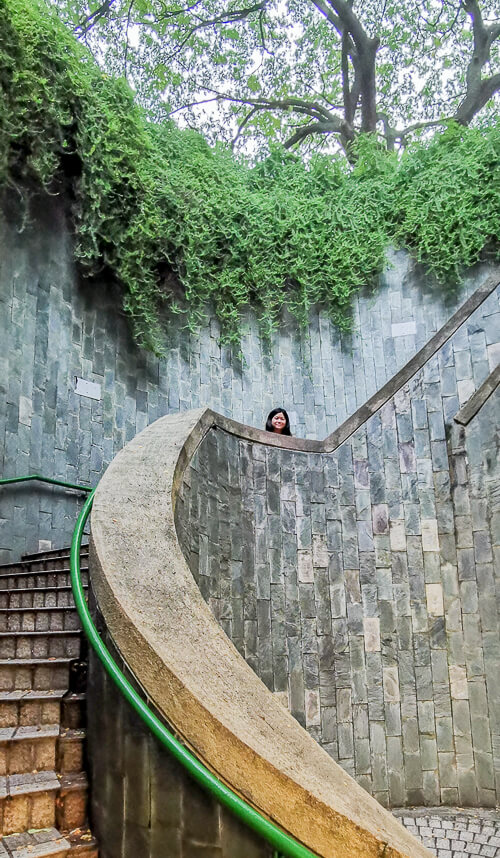

Fort Canning Park is a park located on a hill, at downtown Singapore. This 18 hectares park has several historical buildings and landmarks.
The outer loop around Fort Canning Park is approximately 2km. However, because there are plenty of trails all around the park, you can have various combination of routes. So it’s highly likely that you are still not yet bored of the park when doing your fifth round. Beware that there are plenty of steps!
Read my complete guide to Fort Canning Park.
How to go: Take MRT to Fort Canning Station / Clarke Quay Station / Dhoby Ghaut Station.
Opening hours: 24 hours daily
Location on Google Maps: https://goo.gl/maps/AH6o6BsCcoVsKuCS9
More info on NParks’ site: https://www.nparks.gov.sg/gardens-parks-and-nature/parks-and-nature-reserves/fort-canning-park
20. Alexandra Canal + Singapore River
I think there’s no route as transforming as Alexandra Canal + Singapore River. Why do I think so?
See, you start your run at the beginning of Alexandra Canal Linear Park (near Queenstown MRT). First, you’ll be running through a narrow path within the public housing (HDB). 1.5km into the run, after crossing Tanglin Road, you’ll find yourself running along Alexandra Canal passing by condominiums and shopping mall (Great World City).
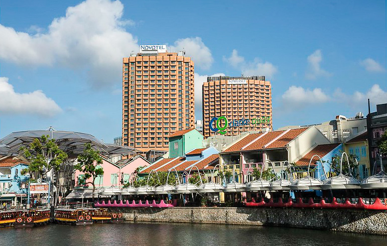
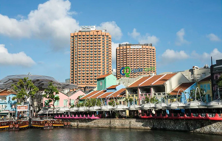
After that, you’ll enter Kim Seng Promenade Park, which marks the start of Singapore River. From here onwards, you’ll enjoy the sights of luxurious condominiums, international hotel chains, the Robertson Quay and Clarke Quay (where expats love to hang out for drinks and meals).
Finally, you’ll arrive at Boat Quay and find that you are surrounded by the CBD, museums and high-rise buildings. Quite a huge contrast to where you start your run from. Isn’t it amazing that you’ll get to enjoy this transformation just by running 6km?
This is one of my favorite running routes in Singapore, and it was where I trained in the early days of my running journey.
How to go: Take MRT to Queenstown Station.
Opening hours: 24 hours daily
Recommended route on Google Maps: https://goo.gl/maps/A9cjrDLyWzpuvUJcA
More info on NParks’ site: https://www.nparks.gov.sg/gardens-parks-and-nature/park-connector-network/alexandra-canal-linear-park, https://www.nparks.gov.sg/gardens-parks-and-nature/park-connector-network/alexandra-pc
21. Singapore Botanic Gardens

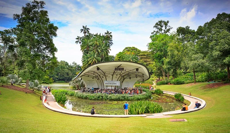
Ever wish you can run in a UNESCO World Heritage Site? Your wish is granted! You can run your heart out at Singapore Botanic Gardens (SBG). For free!
The nice things about running at SBG is the opportunity to admire various faunas, including Singapore’s national flower, the Vanda Miss Joaquim orchid.
The distance between the north gate (Bukit Timah) and south gate (Tanglin) is about 2.3km. However, SBG is pretty big and there are plenty of trails all around the garden, so you can have many combination of routes.
Some landmarks that you should not miss when running in SGB are Swan Lake, Symphony Lake, Ginger Garden and the Orchid Garden. Entrance fee is required for Orchid Garden so I recommend that you visit it at the end of your run, or on another day when you’re not running.
How to go: Take MRT to Botanic Gardens Station.
Opening hours: 5am to 12 midnight daily.
Location on Google Maps: https://goo.gl/maps/2vzYxQDDMpeHxPyb7
More info on NParks’ site: https://www.nparks.gov.sg/gardens-parks-and-nature/singapore-botanic-gardens and https://www.nparks.gov.sg/sbg
22. Rail Corridor

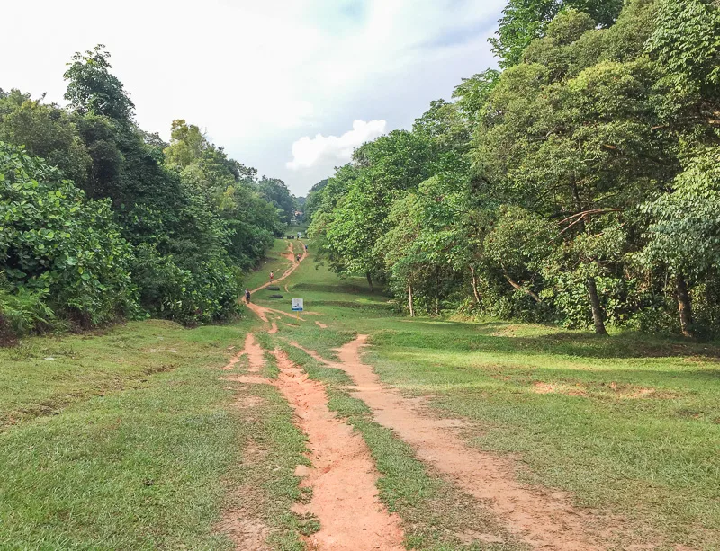
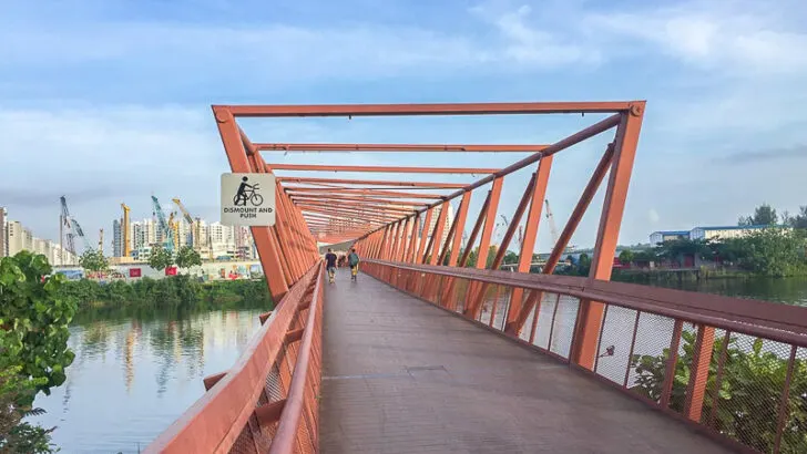
The Rail Corridor was a railway line that connected Singapore and Malaysia in the past. The corridor starts from Tanjong Pagar (former) Railway Station and ends at Woodlands Train Checkpoint.
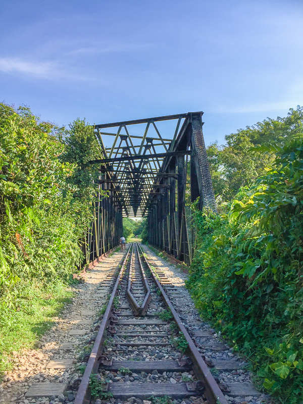
The train stopped operating in 2011. Since then, the railway stations and certain segments along the railway started to gain popularity among locals. Photographers flock to the iconic truss bridge to capture the hidden gem. I, too, had my wedding photoshoot there.

The railway corridor attracted not only photographers, but also runners. Many even petitioned for the railway corridor to be retained and not demolished. Thankfully, the government decided to retain the railway corridor and further develop it to improve biodiversity as well as enhance user experience.
Right now, the development is being carried out progressively, thus, not every segments is open to public yet. Here, you can find details about current progress of the development.
At the time of writing (mid 2020), these are the opened segments:
- from Jalan Kilang Barat to Bukit Timah Railway Station
- from KTM Bukit Timah Railway Bridge to Kranji Close
The total length of the corridor will be 24km when the construction is competed.
Long Distance Routes
I figured that some of you might be long distance runners and perhaps you’re looking for places where you can run for more than 15km.
To accomplish long distance running in Singapore, you’ll have to run across multiple parks or park connectors. NParks has some recommended loops. My favorite has to be the North Eastern Riverine Loop and Eastern Coastal Loop.
Another great long distance route is the Coast to Coast Trail, a 36-km trail spanning from Jurong Lake Gardens to Punggol. I’ve done it and I love the route so much. I have written 2 guides: an overall guide to Coast to Coast Trail and a detailed checkpoint to checkpoint guide.
If you’re attempting any of the long distance routes, I recommend that you bring your own water bottle. Even though water fountain is available at majority of the parks, sometimes the distance between water fountains can be quite far, so it’s better to play safe, I think.
More Route Inspirations
If you have tried all of the above options and you find yourself wanting to explore Singapore more through running, this is my suggestion.
Peruse this extremely comprehensive self-guided walking tours by NParks. Each route has a brochure that explains in detail what you can expect on the walking tour.
Since it is meant for walkers, some routes might be too short for running, so just take note to check the distance before attempting to run.
Want to be the first to know whenever I post new articles and videos? Join my Telegram Channel and you’ll get new post alerts sent directly to your phone.


If you like my work, you can buy me a coffee! Your support will help me to keep going!
Helen Sutanto
Monday 27th of June 2022
Thank you for your wonderful article! Best article i've found
Eva
Monday 27th of June 2022
Thank you Helen!
Sarah
Sunday 19th of December 2021
Hi Eva, you’re doing an awesome job with your blog :)
So much efforts have been put into the useful articles, for both travellers and yes, locals ^^
God bless and you shall have good success in all that you put your hands to! ☀️🌈🌸🌳
Eva
Sunday 19th of December 2021
Hi Sarah, thank you so much for your compliment and well wishes, I appreciate it so much 😊
Don
Tuesday 26th of January 2021
Thank you for the nice article.